agtech.world
Discover the world's top agtech solutions.
Agtech.World aims to be the leading destination to find and showcase agtech solutions from all over the world.
![Advanced Soil Moisture Analytics](https://cdn.agtech.world/1006/01HVY9B10JTRN0F9HRAEBN89EA.png)
Advanced Soil Moisture Analytics Solution
![EOS Data Analytics Inc](https://cdn.agtech.world/1000/01HVY766QRNBQEGKBPCNBFKJJH.png)
Advanced Soil Moisture Analytics
EOS Data Analytics Inc
0
![Ag Data Mapping Solution](https://agtech.world/storage/199/01HJP0GRHWZDHYREBP2E9N11EW.jpg)
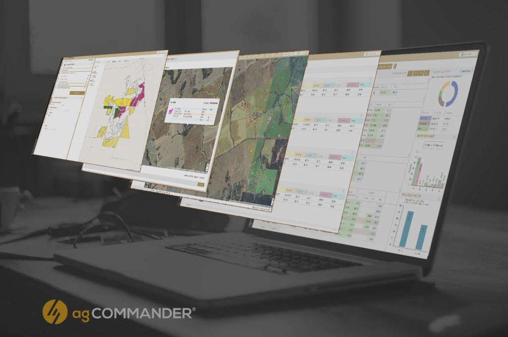
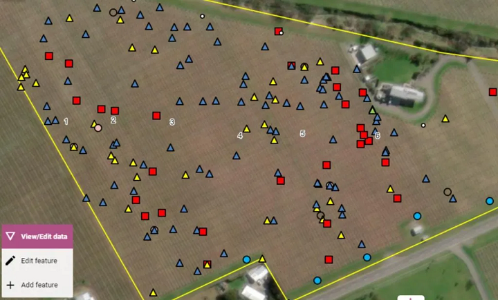
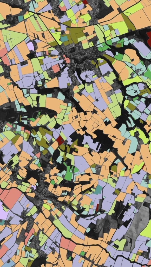
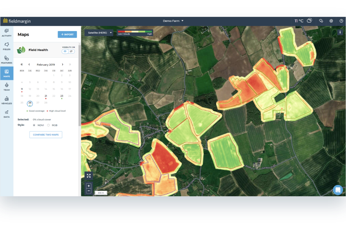
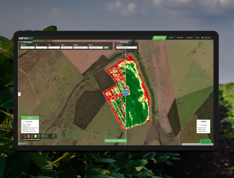
The Ultimate Ag Data Mapping Solution
![GK Technology Inc.](https://agtech.world/storage/198/01HJP04WE1K4JFRQMKEE7FQ2PH.jpg)
Ag Data Mapping Solution
GK Technology Inc.
0
![AgKonect Turf](https://cdn.agtech.world/1321/01HYB899ENMFTKJQANM5K4YTBM.png)
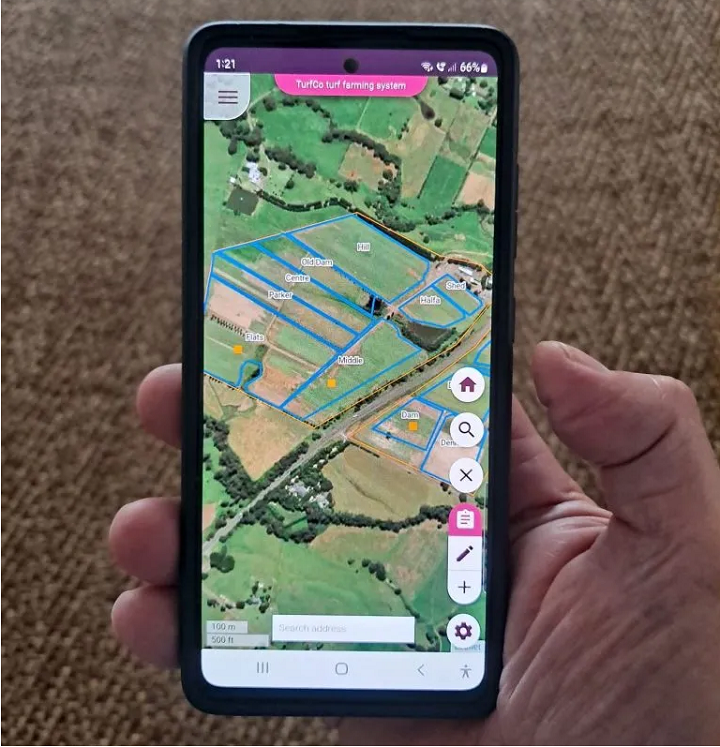
Simple software for turf farmers and managers
![AgKonect](https://cdn.agtech.world/1320/01HYB7ZN24GQM7Q8ETYDGZPH1K.jpg)
AgKonect Turf
AgKonect
0
![AgKonect Vineyard](https://cdn.agtech.world/1322/01HYB8SN01HER76Q1AWYC16NB8.png)
Simple, powerful app for vineyard management
![AgKonect](https://cdn.agtech.world/1320/01HYB7ZN24GQM7Q8ETYDGZPH1K.jpg)
AgKonect Vineyard
AgKonect
0
![Altum-PT](https://cdn.agtech.world/1231/01HXERP4JXWH54JVE4PGDD4ZMZ.jpg)
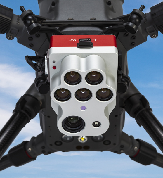
Optimized 3-in-1 solution for advanced remote sensing and agricultural research.
![AgEagle Aerial Systems Inc](https://cdn.agtech.world/1226/01HXEP5W06Q2Z37ZT7RJCHBT6J.jpg)
Altum-PT
AgEagle Aerial Systems Inc
0
![Crop Monitoring](https://cdn.agtech.world/1001/01HVY7KBWH1X19Z7NM7A6V4E7F.png)
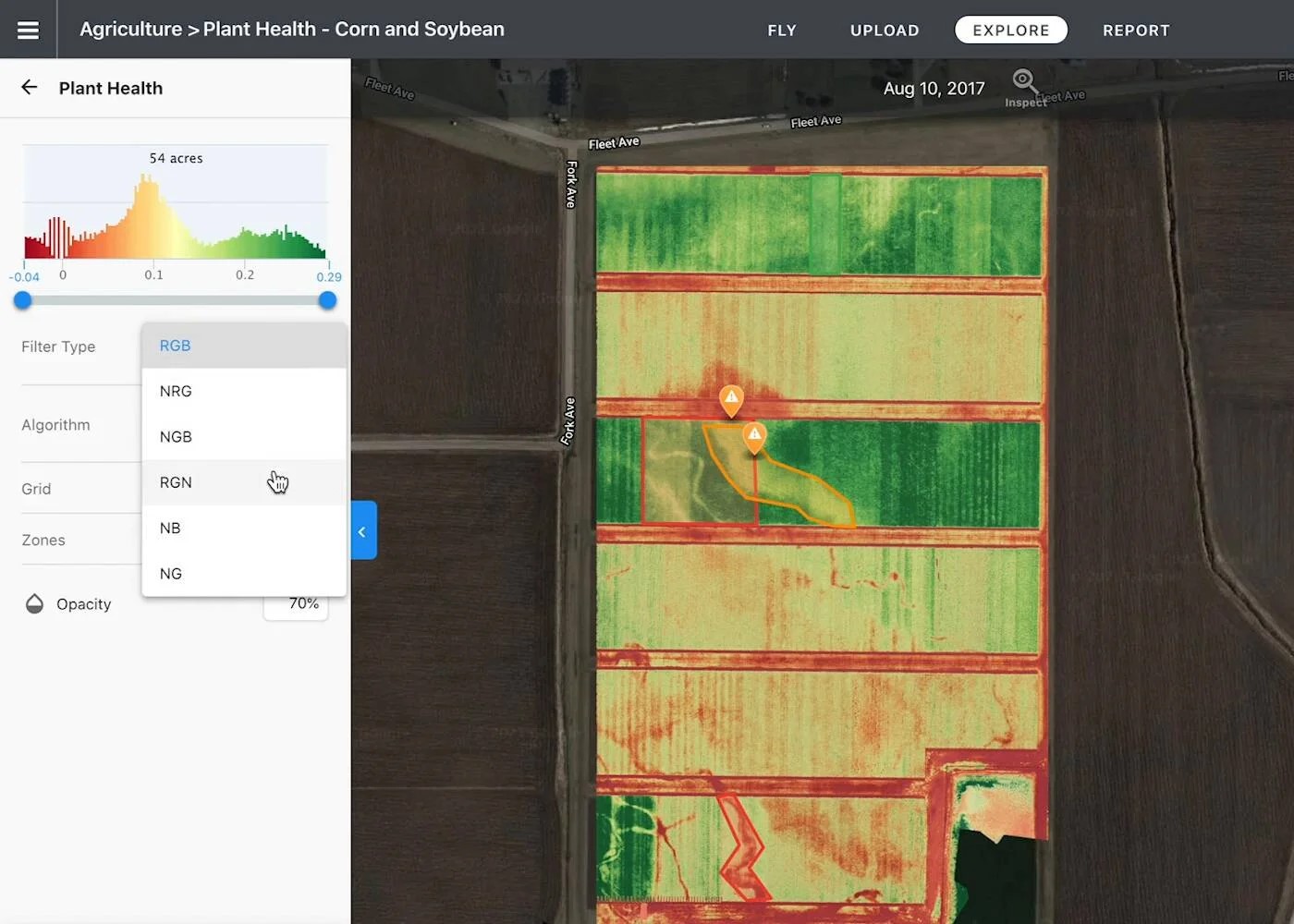
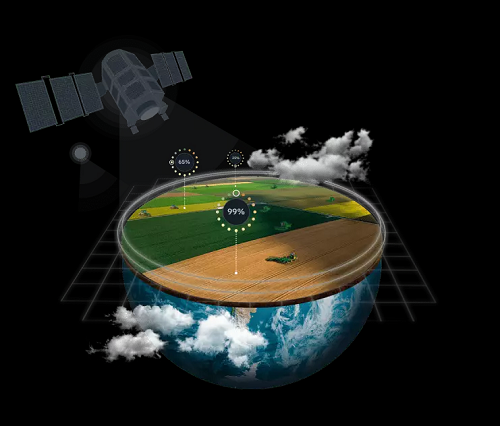
Empowering agricultural businesses with remote farm monitoring
![EOS Data Analytics Inc](https://cdn.agtech.world/1000/01HVY766QRNBQEGKBPCNBFKJJH.png)
Crop Monitoring
EOS Data Analytics Inc
0
![Crop Type Classification](https://cdn.agtech.world/1004/01HVY8T04A5BME1NCKQZBG319B.png)
Crop Type Classification Using Remote Sensing
![EOS Data Analytics Inc](https://cdn.agtech.world/1000/01HVY766QRNBQEGKBPCNBFKJJH.png)
Crop Type Classification
EOS Data Analytics Inc
0
![CropMap](https://cdn.agtech.world/1399/01HYN39SZ92S9HE0S4CZEEJ8C1.png)
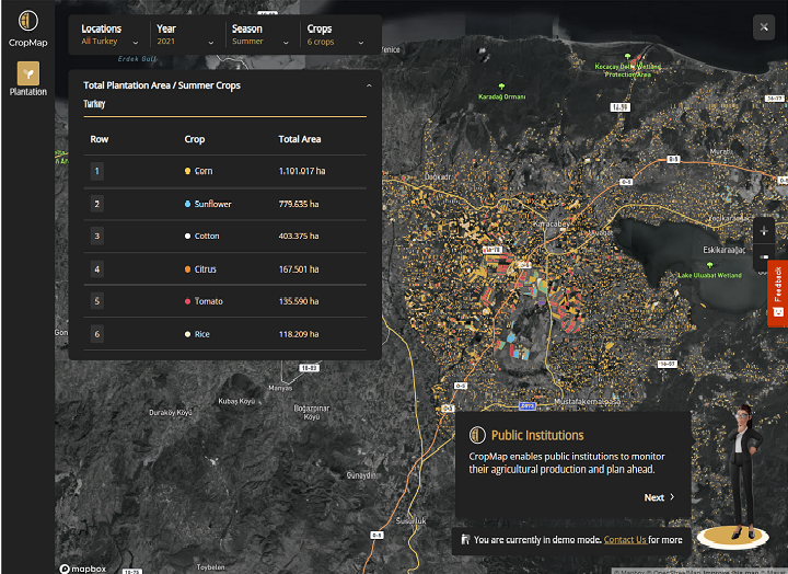
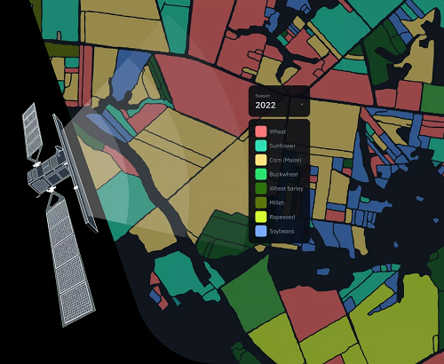
CropMap transforms agricultural data into actionable market insights by detecting field boundaries and crop types.
![Doktar](https://cdn.agtech.world/1378/01HYMTP1D50YH1JC2J1DF4Z74F.jpg)
CropMap
Doktar
0
![Cropwise IMAGERY](https://cdn.agtech.world/911/01HVP8NHAFYJZ1JNGB2QA0VR0F.png)
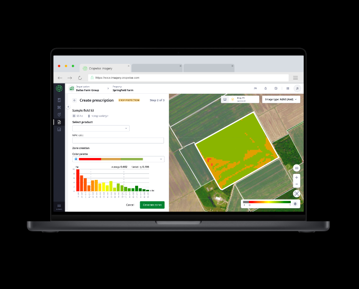
A bird’s eye view of the farm
![Syngenta](https://agtech.world/storage/56/01HJ6H5Z6GHSGZP6FYZFJFZNCH.png)
Cropwise IMAGERY
Syngenta
0
![Digital Agronomist](https://agtech.world/storage/669/01HSDQE98H7S5QZR0DM5NXVM14.jpg)
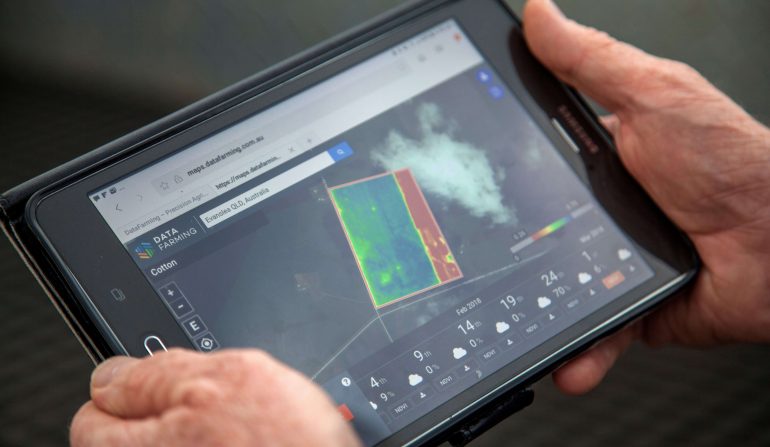
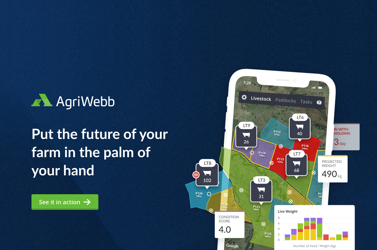
We’re working to put farmers and agronomists in control.
![DataFarming Pty Ltd](https://agtech.world/storage/668/01HSDPWN41066H3AKFZ8MK2TFG.jpg)
Digital Agronomist
DataFarming Pty Ltd
1
![Digital Soil Map](https://cdn.agtech.world/1091/01HWFTGHGCYMEQV5GM4FNQX9XJ.jpg)
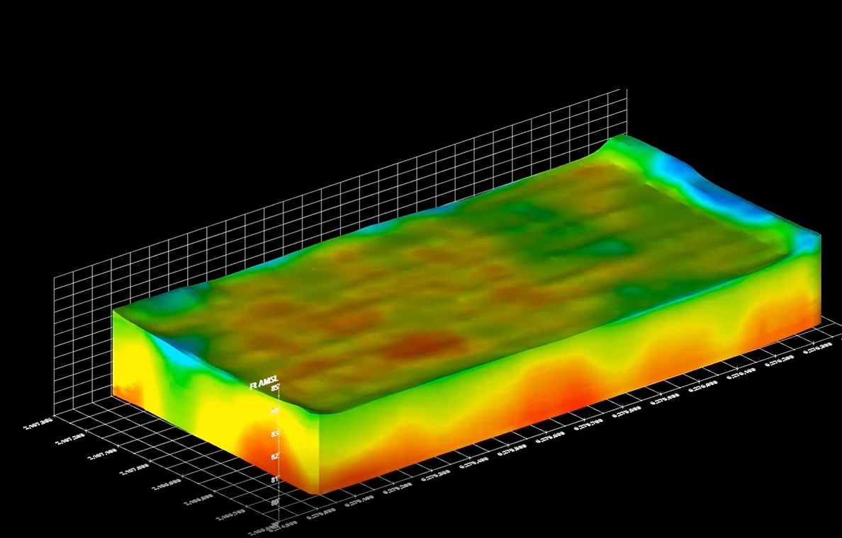
Enabling next-level precision irrigation.
![LandScan LLC](https://cdn.agtech.world/1087/01HWFBA3M326EFN4MCQDP0RGRA.jpg)
Digital Soil Map
LandScan LLC
0
![EOSDA Forest Monitoring](https://cdn.agtech.world/1008/01HVYA04PSZ7KQEYC7JQYG8Q2H.png)
Forest Monitoring Using Remote Sensing: Solution By EOSDA
![EOS Data Analytics Inc](https://cdn.agtech.world/1000/01HVY766QRNBQEGKBPCNBFKJJH.png)
EOSDA Forest Monitoring
EOS Data Analytics Inc
0
![Field Boundary Detection](https://cdn.agtech.world/1003/01HVY8CZ6Q4ZBVQA3ZKTERZPDS.png)
Automatic Field Boundary Detection Using Neural Networks
![EOS Data Analytics Inc](https://cdn.agtech.world/1000/01HVY766QRNBQEGKBPCNBFKJJH.png)
Field Boundary Detection
EOS Data Analytics Inc
0
![FieldLook](https://cdn.agtech.world/1081/01HWF8NA564VAHQ8181BETB08A.png)
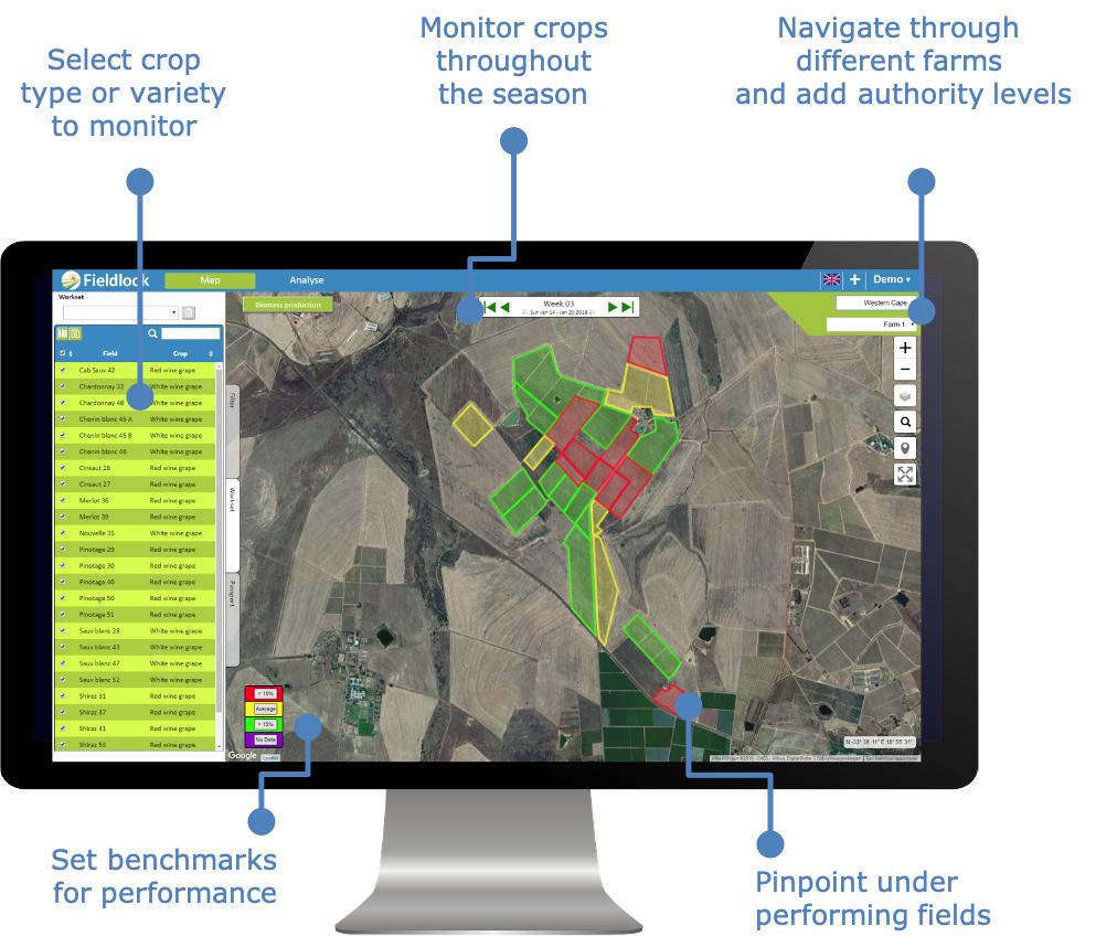
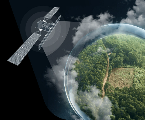
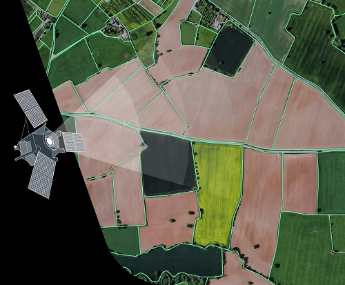
Our agricultural services support farmers to optimise crop production levels, detect anomalies early on and use resources sustainably.
![eLEAF](https://cdn.agtech.world/1080/01HWF86K47N3X44R77W2PKXN5G.jpg)
FieldLook
eLEAF
0
![FlytMini](https://cdn.agtech.world/832/01HV6PAAVD6BBS704XZG75HBXG.jpg)
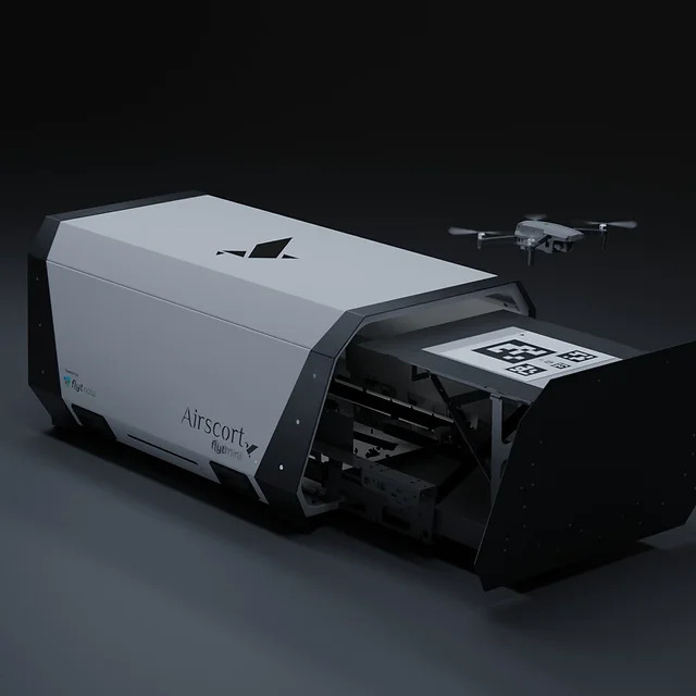
Fully autonomous drone
![Airscort Ltd.](https://cdn.agtech.world/831/01HV6KW7P3YDJ5DRG9WFH9C90V.jpg)
FlytMini
Airscort Ltd.
0
![Gatekeeper](https://agtech.world/storage/22/01HJ66RCYF8YK670EKRYZ9VNRB.png)
Get value from your crops faster
![Proagrica](https://agtech.world/storage/400/01HRY3VN81K5Y85F9NVEP1W5G3.png)
Gatekeeper
Proagrica
0
![Harvest Dynamics Monitoring](https://cdn.agtech.world/1005/01HVY92MYAQM2GXXZ7TC20V4E2.png)
Remote Harvest Dynamics Monitoring
![EOS Data Analytics Inc](https://cdn.agtech.world/1000/01HVY766QRNBQEGKBPCNBFKJJH.png)
Harvest Dynamics Monitoring
EOS Data Analytics Inc
0
![Land App](https://cdn.agtech.world/1357/01HYD3GWCHEBK4BPZKZZ5ZRXN0.png)
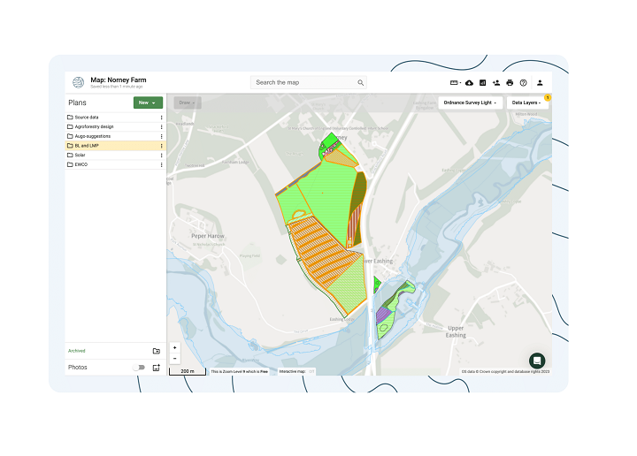
Design a Sustainable Planet, Together. Collaborative, Intuitive Mapping for the Land Sector.
![DigitalLandSolutions Ltd](https://cdn.agtech.world/1356/01HYD33GE0V7CVQF9MENWJWBK5.jpg)
Land App
DigitalLandSolutions Ltd
0
![OneSoil Global Analytics](https://agtech.world/storage/266/01HMEP77PMRS4R3BG5XMMZM0F6.jpg)
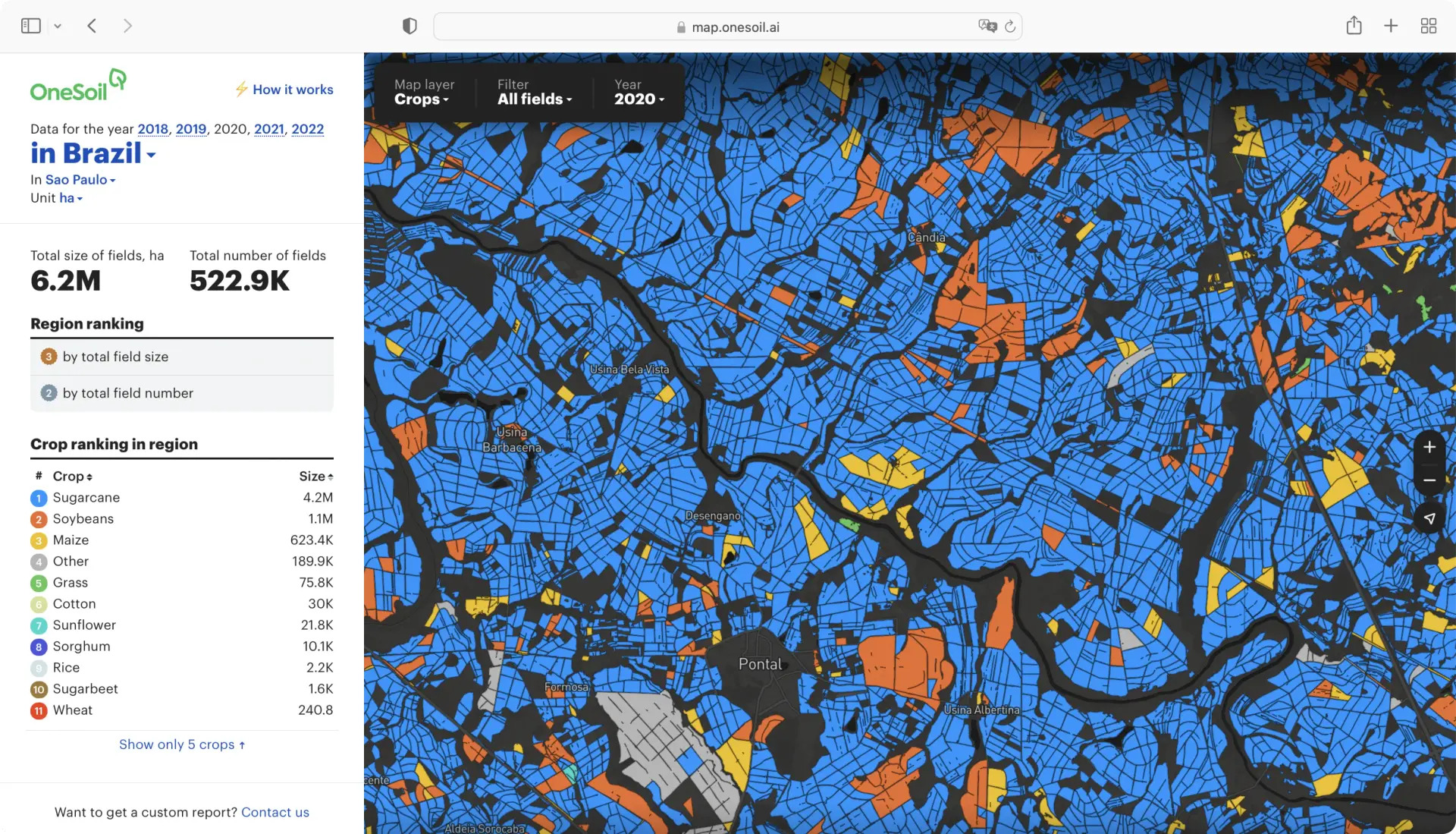
Get Agricultural Data on Any Region
![OneSoil AG](https://agtech.world/storage/256/01HMBC93F1RNM9GYN3EQMHCVZC.jpg)
OneSoil Global Analytics
OneSoil AG
0
![Onside App](https://cdn.agtech.world/791/01HSKCAZGYWBQNPK6MZTNXTZ05.jpg)
Rural compliance made mobile
![Onside](https://cdn.agtech.world/790/01HSKBV9X5WR9W319HRC1EQ3NW.jpg)
Onside App
Onside
0
![Pairtree PLUS](https://cdn.agtech.world/1293/01HY5KHKKBVH74TKCQ94Q8SGM0.jpg)
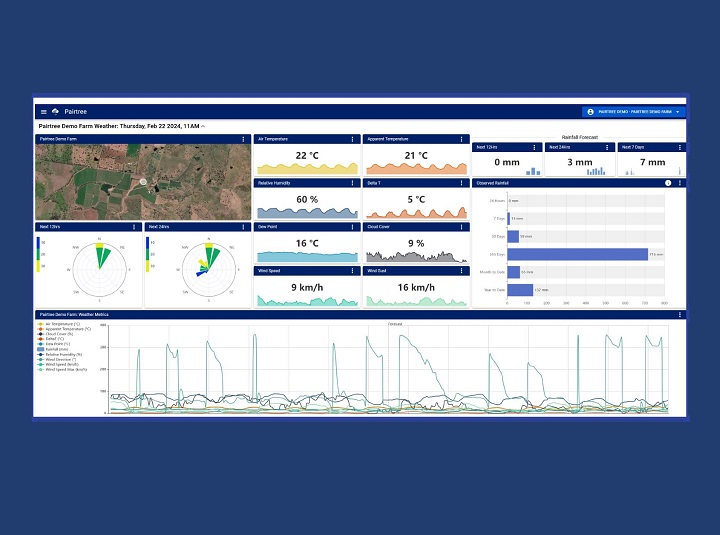
Imagine all the farm data you need connected in one place.
![Pairtree Intelligence Pty Ltd](https://cdn.agtech.world/1284/01HY5JP4RPFN7VESTQXRYEDWRB.jpg)
Pairtree PLUS
Pairtree Intelligence Pty Ltd
0
![QGIS](https://cdn.agtech.world/1360/01HYD4BWFN8J85XPE5TX5TDPWJ.png)
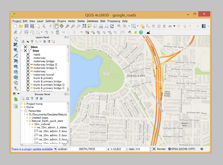
A Free and Open Source Geographic Information System. Create, edit, visualise, analyse and publish geospatial information on Windows, macOS, Linux, BSD and mobile devices.
![QGIS.ORG](https://cdn.agtech.world/1359/01HYD3VNH728BED4E6VWJECRG7.png)
QGIS
QGIS.ORG
1
![SD Drain Ditch](https://agtech.world/storage/207/01HJP19T98H542YYZVR3S4FWW3.png)
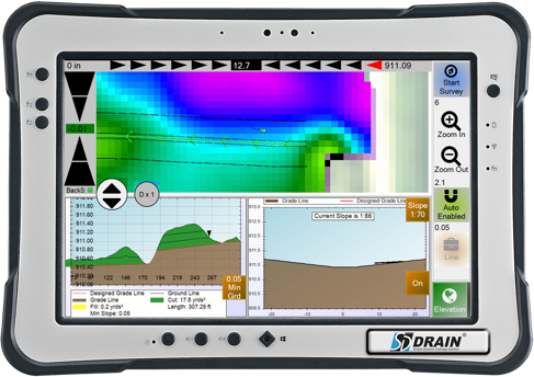
Whether you’re cleaning out existing ditches or making new ones, this simple to operate system easily plugs into your existing RTK GNSS and automatically controls the scraper blade to make water flow. Includes patented Automated Backslope Cutting Feature.
![GK Technology Inc.](https://agtech.world/storage/198/01HJP04WE1K4JFRQMKEE7FQ2PH.jpg)
SD Drain Ditch
GK Technology Inc.
0
![SD Drain Tile](https://agtech.world/storage/218/01HJP1VF4T3F2WGKERBCNCMT4J.png)
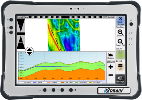
Use your existing RTK GNSS to accurately place and record the size and location of your drain tile. Powerful editing tools are simple to use and allow you to easily modify a tile run.
![GK Technology Inc.](https://agtech.world/storage/198/01HJP04WE1K4JFRQMKEE7FQ2PH.jpg)
SD Drain Tile
GK Technology Inc.
0
![Satamap Global](https://cdn.agtech.world/1239/01HXEWAGS8QCW4E8FS3G8XCM11.jpg)
Satamap Global is web based platform for viewing and analysing satellite imagery available anywhere in the world.
![PCT Agcloud Pty Ltd](https://cdn.agtech.world/1238/01HXEVR4RZ7ADN0HV36KTHK99T.jpg)
Satamap Global
PCT Agcloud Pty Ltd
0
![Skippy Scout](https://agtech.world/storage/384/01HQX9G2MT88H22B6C60CRCYY5.jpg)
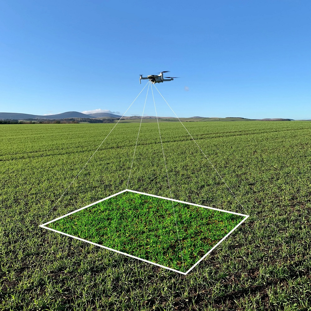
Leverage the power of drones.
![Drone Ag Limited](https://agtech.world/storage/378/01HQX82JHHTRWTH1NNSQV7J305.png)
Skippy Scout
Drone Ag Limited
0
![Soil Organic Carbon](https://cdn.agtech.world/1007/01HVY9H5TBR69QDW5Q8FH6XXC1.png)
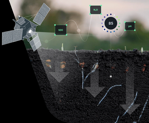
Soil Organic Carbon Modeling: Experience the Difference with Our Method
![EOS Data Analytics Inc](https://cdn.agtech.world/1000/01HVY766QRNBQEGKBPCNBFKJJH.png)
Soil Organic Carbon
EOS Data Analytics Inc
0
![TMS TreeScout](https://cdn.agtech.world/1079/01HWF7P8PBQM0DKFRYKYWNZZVE.png)
The Crop Intelligence Company
![Aurea Imaging](https://cdn.agtech.world/1078/01HWF7A3KB08VT3XNK6PZCKB34.jpg)
TMS TreeScout
Aurea Imaging
0
![Yield Monitor](https://agtech.world/storage/229/01HJP2A7T6DV9DDZBT3D9RCGHQ.png)
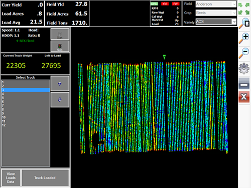
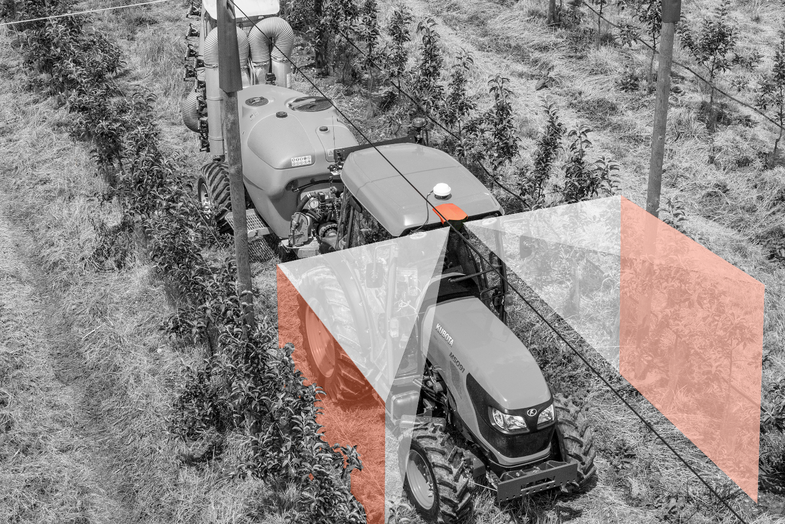
Truck Crop Yield Monitoring / Mapping
![GK Technology Inc.](https://agtech.world/storage/198/01HJP04WE1K4JFRQMKEE7FQ2PH.jpg)
Yield Monitor
GK Technology Inc.
0