We develop deep neural network models and agtech solutions for accurately detecting field boundaries and seeded acres in precision farming. Let us help you take your agriculture business to the next level.
- Global Coverage
We’re always working hard to bring new regions like France, Spain, Brazil, US, Australia, Germany and 30+ more. - Historical Data
We provide our models with agri data historically (back to 2016) and in-season including seeded acres. - Predictable Price
We've prepared a convenient system of discounts for increasing the volume of use. More requests - less price. - CEO Is A Farmer
15th generation farmer from Norway, passionate about sustainable agriculture and farming heritage.
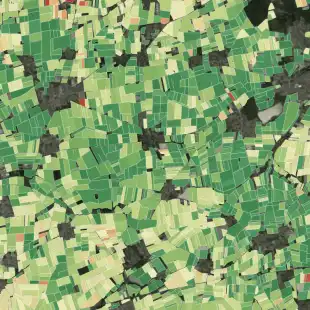
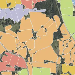
Field Boundaries
We have developed state-of-the-art deep neural network model for Field Delineation with 12-15% higher accuracy than current existing datasets based on models using super-high resolution (1m per/pixel) coupled with extensive training data (IoU of 0.96).
Productivity Zones
Take advantage of the superior quality of our Deep Resolution Imagery and Field Boundaries to deliver highly accurate and customizable Productivity Zones that enable various precision AG services (VRT of fungicides / fertilizers / seeds, monitoring field homogeneity, etc) and strengthen in-field analytics.
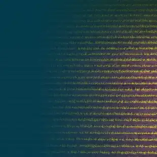
S2 Time Series
Long-term and in-season cloud filtered vegetation indices (EVI, NDVI, NDMI, MI+) all in one place for each field boundary, with access to pre-processed data and on demand processing capability coming soon.
Sustainability Index
Based on our proprietary patented algorithm, the DigiFarm Sustainability Index (DFSI) provides reliable information on the sustainability of crop production of every field on Earth. DFSI information is crucial for many industries, such as crop insurance, land management and valuation, agricultural finances.
Crop Classification
We detect crop types historically back to 2016 as well as in the growth season, approx. 31-37 on Zadoks scale depending on the region and crop-type. In a Norwegian context we start run the model in the middle of July and achieve our best results in mid-August.
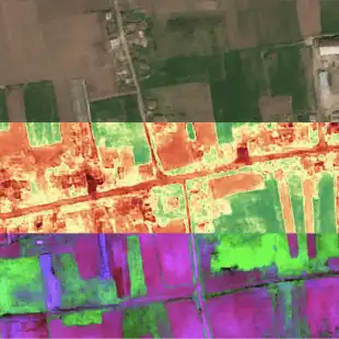
Satellite Imagery
With just a few clicks, transform any Sentinel 2 satellite image from 10m/pixel to 1m/pixel GSD. Not only that, you'll get 10 enhanced S2 spectral bands as output.
Gallery