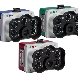
RedEdge-P features a high-resolution panchromatic band for pan-sharpened output resolutions of 2 cm / 0.8 in at 60 m / 200 ft.
Its five narrow multispectral bands with scientific-grade filters make it the perfect camera for calculating multiple vegetation indices and composites. NDAA compliant.
High resolution panchromatic sensor
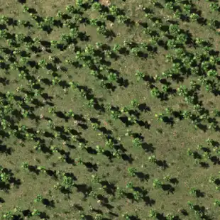
With a high-resolution panchromatic imager, RedEdge-P enables higher-resolution RGB and multispectral outputs – 2 cm per pixel / 0.78 in per pixel resolution when flying at 60 m / 200 ft . With sharper imagery, you can spot smaller problems or features sooner and make more reliable management decisions across a variety of use cases.
Five multispectral bands at 1.6 MP each
- Blue (475 nm center, 32 nm bandwidth)
- Green (560 nm center, 27 nm bandwidth)
- Red (668 nm center, 14 nm bandwidth)
- Red edge (717 nm center, 12 nm bandwidth)
- Near-IR (842 nm center, 57 nm bandwidth)
Five multispectral bands at 1.6 MP each
- Blue (475 nm center, 32 nm bandwidth)
- Green (560 nm center, 27 nm bandwidth)
- Red (668 nm center, 14 nm bandwidth)
- Red edge (717 nm center, 12 nm bandwidth)
- Near-IR (842 nm center, 57 nm bandwidth)
Global shutter
The global shutter of RedEdge-P allows for distortion-free image captures.
Increase data accuracy and repeatability
- Calibrated multispectral imagery
Each RedEdge-P camera kit comes with a Reflectance Panel for on-the-ground calibration as well as a DLS2 light sensor for irradiance and sun angle measurements. These radiometric calibration tools account for different weather and light conditions, providing more accurate, reliable data that enable time series analysis and comparability of outputs over time. - Powerful AI capabilities
Thanks to the panchromatic band, RedEdge-P enables high-resolution RGB and multispectral imagery for machine learning applications such as plant counting and advanced vegetation research applications. - Compatible with a wide range of drones and processing software
The RedEdge-P SkyPort ensures perfect compatibility with DJI’s M300 RTK drones. The camera also features an open API interface for easy integration with many popular drone and software platforms. - Synchronized capture of high-res RGB and multispectral
Simultaneous capture of up to six bands, enabling multiple high-resolution outputs such as RGB, crop vigor indices and composites (NDVI, NDRE, CIR), and high-resolution panchromatic.
Designed specifically for UAV and vegetation mapping
- Plant counting
- Phenotyping
- Plant health mapping
- Fertilizer management
- Disease identification
- Species differentiation
- Advanced crop scouting
- High-res 3D point clouds
Gallery
Reviews
Sign-in to leave a review for the solution.
0.0/5
0 Reviews
Questions
Sign-in to leave ask a question about the solution.
