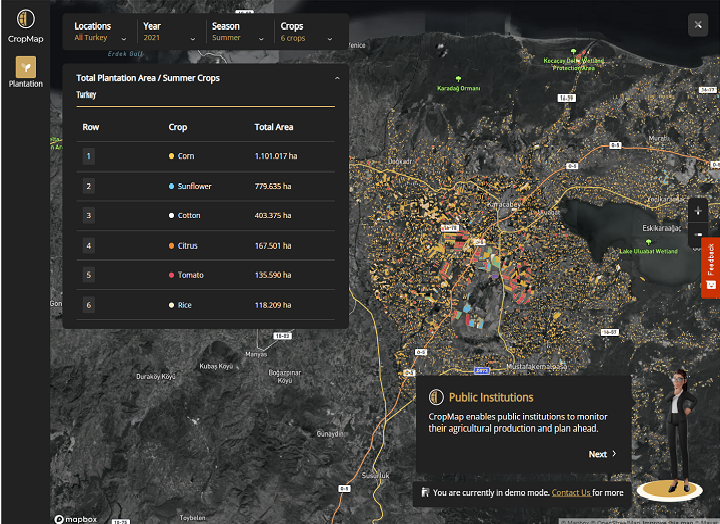
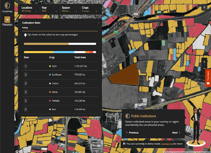
More Precise Insights with CropMap
CropMap transforms agricultural data into actionable market insights by detecting field boundaries and crop types. Use CropMap to precisely measure market volume and segmentation, make accurate predictions, optimize your operations and minimize production cost.
CropMap is already available in most regions of the world. If we are not in yours yet, just let us know and we will integrate CropMap into your region in a matter of weeks.
What We Offer
- Field Boundary Detection
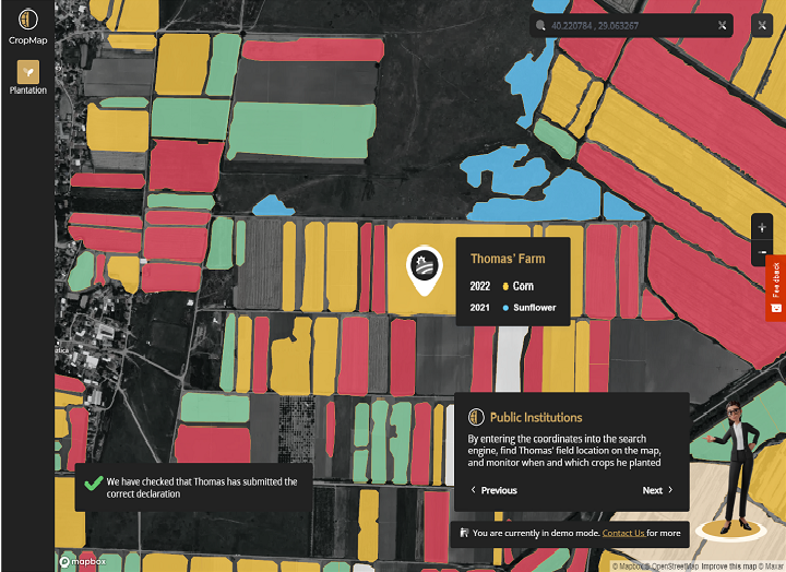
Detecting field boundaries provides you with the correct data about the region's field areas, allowing you to organise your production precisely. - Crop Type Monitoring
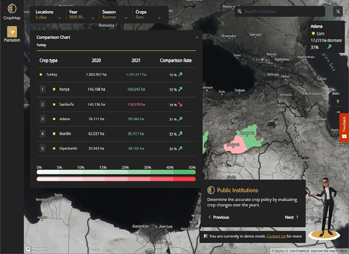
Crop Type Monitoring allows you to identify the cropping pattern and determine volume of production. - Harvest Monitoring
We provide current, historical harvest data and harvest prediction both in map and report as customers demand which is important for optimizing operations and minimizing production cost. - Tailored Agricultural Solutions
We provide tailored agricultural solutions. There are no limits on how you can use CropMap. You can customize your account by choosing the region, crop and data that you need.
Why CropMap?
- 98% Accuracy
We offer up to 98% accuracy. - 17 Crops Available
Cotton, rice, corn, wheat, barley, tomato, potato, canola, citrus, sunflower, vineyard, pepper, sugar beet, melon, watermelon, soybean, peanuts - Global Regions
As we are an international company we are now in many countries and our models can be easily expanded to other regions. - 100,000+ Ground Truth
Each year more than 100,000 ground truth samples are collected per region. - 10+ Years of Experience
We are a team of multidisciplinary experts dedicated to serve our clients with highly sustainable solutions
in their core business activities. - AI Solutions
Field boundary detection and crop type identification with remote sensing, GIS and AI based algorithms.
Gallery
Reviews
Sign-in to leave a review for the solution.
0.0/5
0 Reviews
Questions
Sign-in to leave ask a question about the solution.