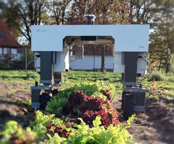
PlantMap (Powerful Long-term Autonomous Navigation Towards Monitoring Agricultural Plants) is a project developed by the DFKI Niedersachsen in Osnabrück that comprises a start-up under the EXIST transfer of research programme, in which an autonomously navigating robot is employed to generate a temporally and spatially high resolved, three-dimensional plant map of individual plants as well as entire beds to support ecological agriculture.
- Waypoint Navigation
Interactive Waypoint Navigation for Autonomous Monitoring of Vegetables in Complex Micro-Farming - Flexible Navigation Control
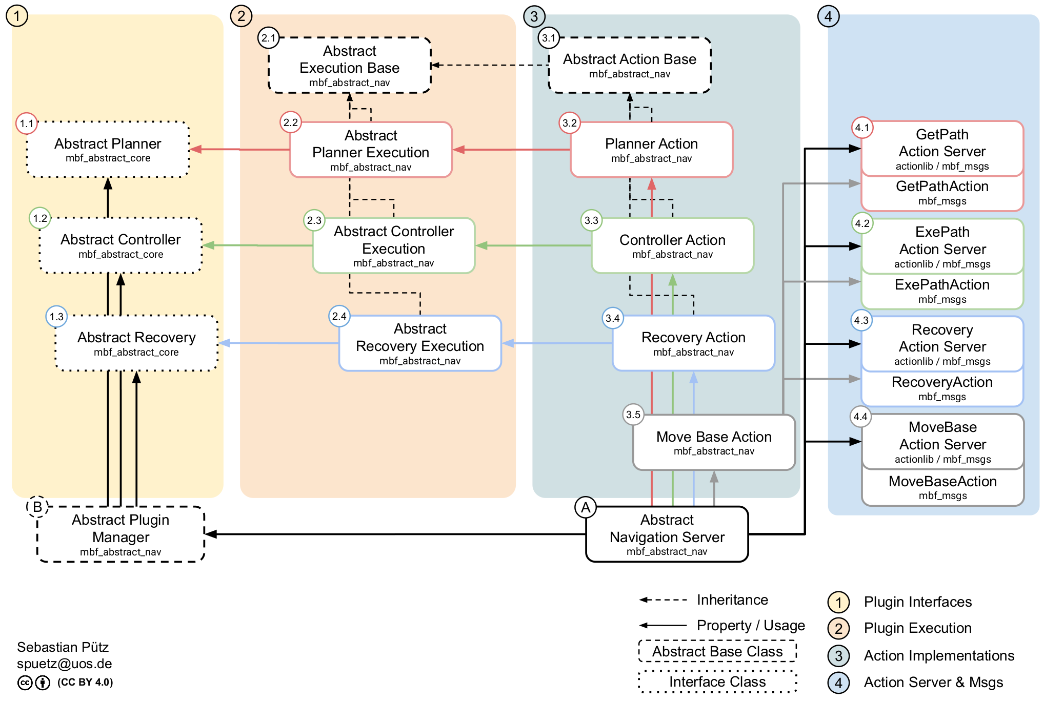
Autonomous Robot 2D Navigation Control Move Base Flex - 3D Environment mapping
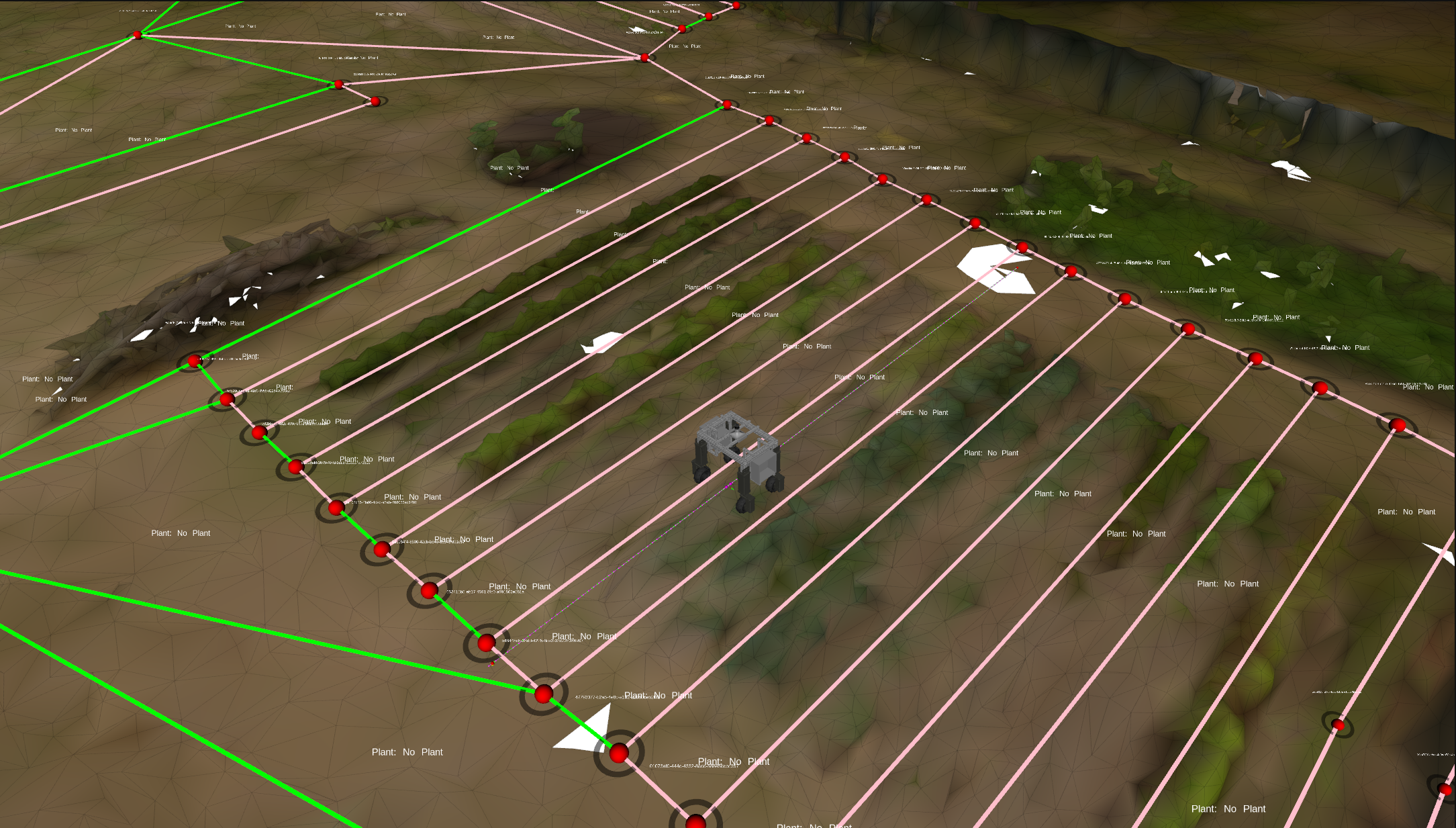
3D environment maps and datasets - 3D Mesh Navigation
Autonomous Robots 3D Mesh Navigation - 3D Plant Mapping
Automatic 3D Plant Mapping - Plant Instance Segmentation
Plant segmentation
Gallery
Reviews
Sign-in to leave a review for the solution.
0.0/5
0 Reviews
Questions
Sign-in to leave ask a question about the solution.