agtech.world
Discover the world's top agtech solutions.
Agtech.World aims to be the leading destination to find and showcase agtech solutions from all over the world.
![Advanced Soil Moisture Analytics](https://cdn.agtech.world/1006/01HVY9B10JTRN0F9HRAEBN89EA.png)
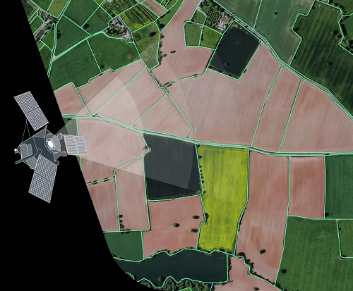
Advanced Soil Moisture Analytics Solution
![EOS Data Analytics Inc](https://cdn.agtech.world/1000/01HVY766QRNBQEGKBPCNBFKJJH.png)
Advanced Soil Moisture Analytics
EOS Data Analytics Inc
0
![Australian Feedbase Monitor](https://cdn.agtech.world/769/01HSJW42Y8KKX8BMPR6ZPXBJBP.png)
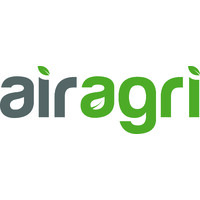
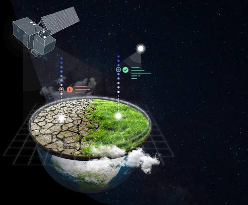
The Australian Feedbase Monitor (AFM) is a new grazing management tool which gives land managers satellite insights into their feed capabilities.
![Cibolabs Pty Ltd](https://cdn.agtech.world/766/01HSJVD0VJE4A56JP9K3G5CDPK.jpg)
Australian Feedbase Monitor
Cibolabs Pty Ltd
0
![Crop Intelligence](https://cdn.agtech.world/834/01HV6QB866ZV7AR3WF711K8WTQ.png)
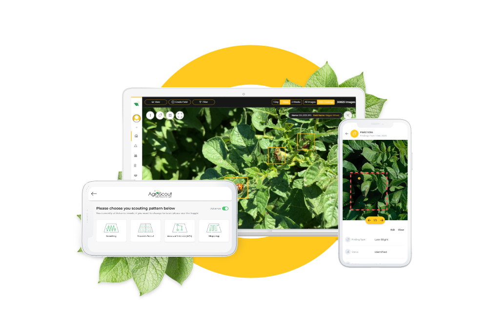
The AgroScout platform monitors crop development in real-time, to more accurately plan processing and manufacturing operations across regions, crops and growers.
![Agroscout](https://cdn.agtech.world/833/01HV6PS7TFNYJG833Q3XB9314P.png)
Crop Intelligence
Agroscout
0
![Crop Monitoring](https://cdn.agtech.world/1001/01HVY7KBWH1X19Z7NM7A6V4E7F.png)
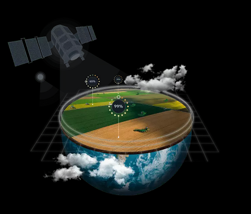
Empowering agricultural businesses with remote farm monitoring
![EOS Data Analytics Inc](https://cdn.agtech.world/1000/01HVY766QRNBQEGKBPCNBFKJJH.png)
Crop Monitoring
EOS Data Analytics Inc
0
![Crop Type Classification](https://cdn.agtech.world/1004/01HVY8T04A5BME1NCKQZBG319B.png)
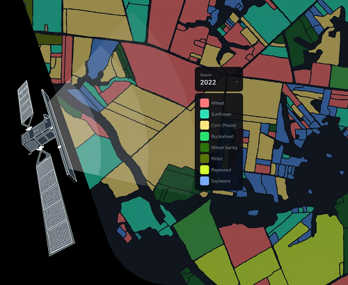
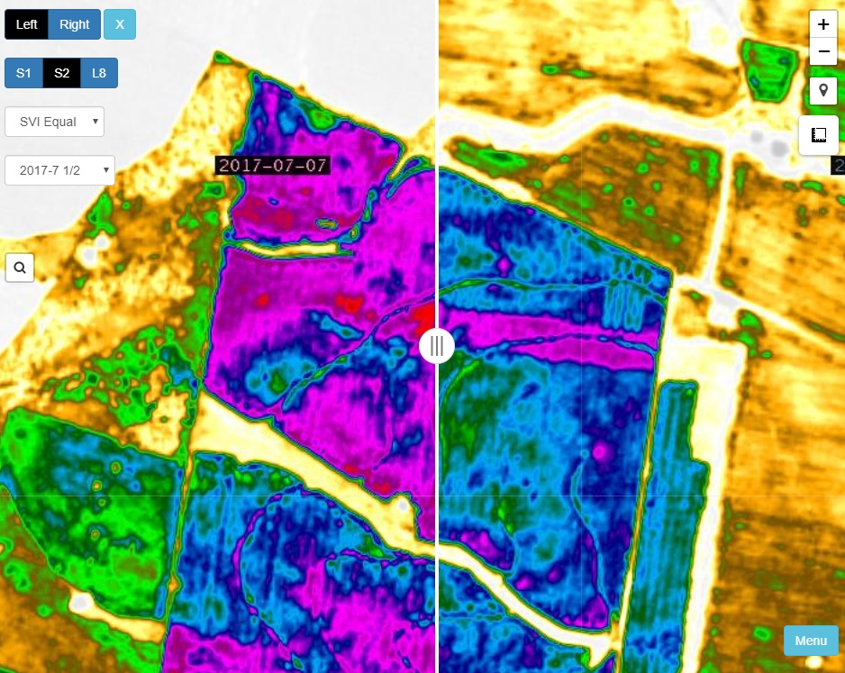
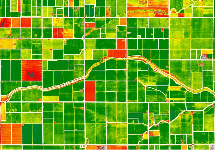
Crop Type Classification Using Remote Sensing
![EOS Data Analytics Inc](https://cdn.agtech.world/1000/01HVY766QRNBQEGKBPCNBFKJJH.png)
Crop Type Classification
EOS Data Analytics Inc
0
![Cropwise IMAGERY](https://cdn.agtech.world/911/01HVP8NHAFYJZ1JNGB2QA0VR0F.png)
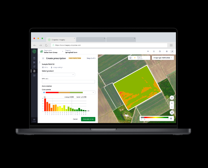
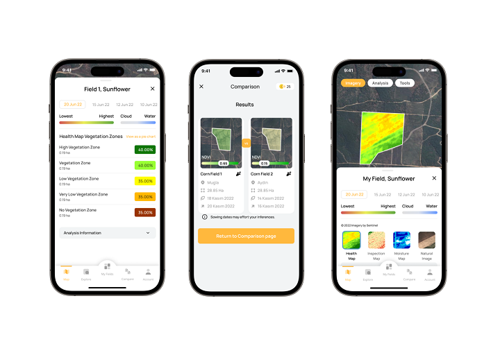
A bird’s eye view of the farm
![Syngenta](https://agtech.world/storage/56/01HJ6H5Z6GHSGZP6FYZFJFZNCH.png)
Cropwise IMAGERY
Syngenta
0
![Cropwise OPERATIONS](https://cdn.agtech.world/916/01HVP93NRM9ENE637KJ0009EV9.jpg)
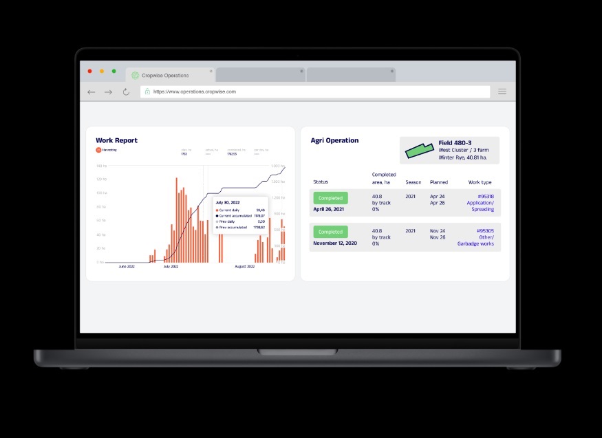
All in one digital farming solution
![Syngenta](https://agtech.world/storage/56/01HJ6H5Z6GHSGZP6FYZFJFZNCH.png)
Cropwise OPERATIONS
Syngenta
0
![Cropwise PLANTING](https://cdn.agtech.world/910/01HVP8JXV9GCGMM9YMEW3SKV38.jpg)
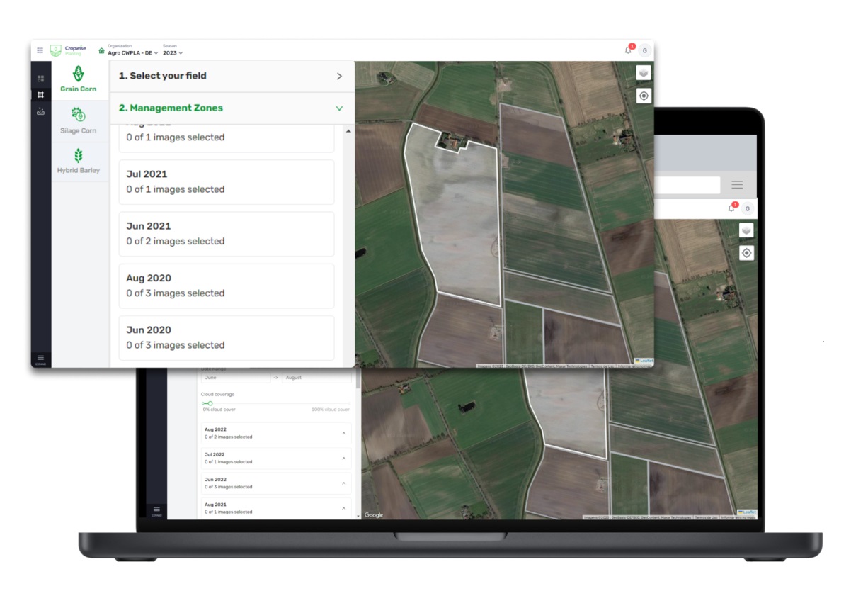
Unleashing the full potential of your fields and seeds
![Syngenta](https://agtech.world/storage/56/01HJ6H5Z6GHSGZP6FYZFJFZNCH.png)
Cropwise PLANTING
Syngenta
0
![Digital Agronomist](https://agtech.world/storage/669/01HSDQE98H7S5QZR0DM5NXVM14.jpg)
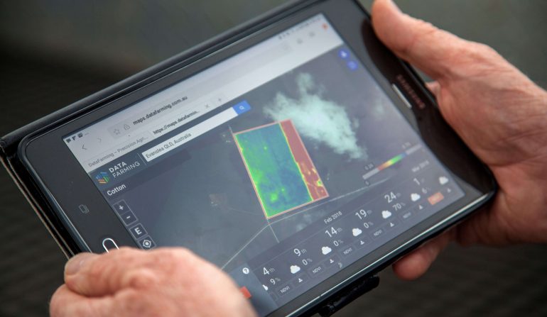
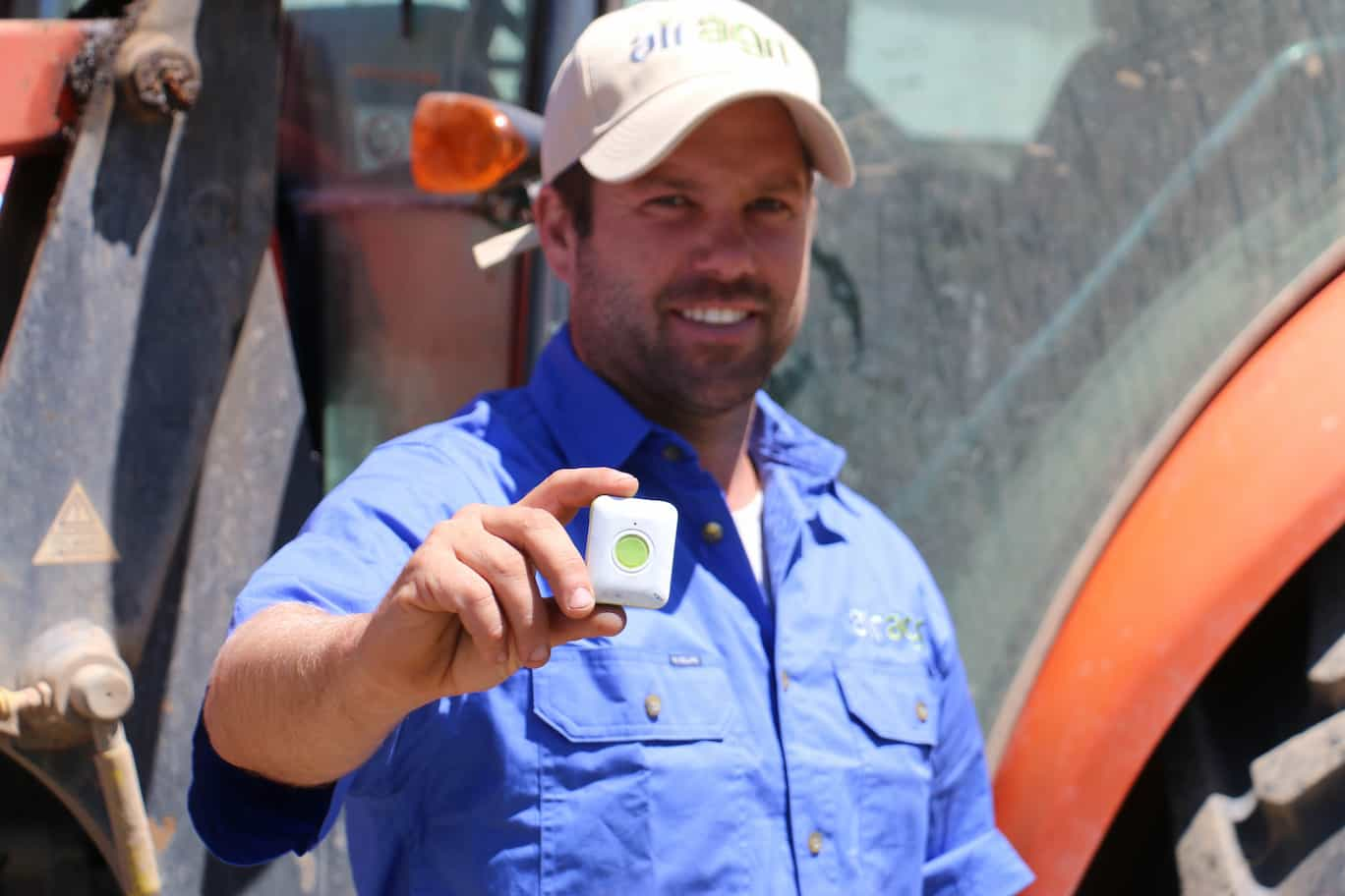
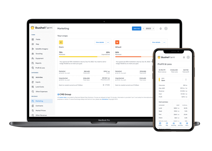
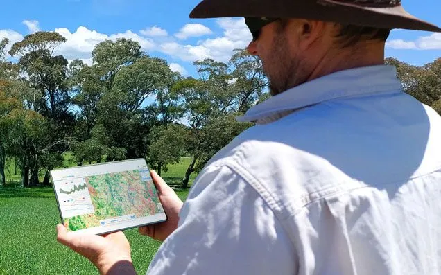
We’re working to put farmers and agronomists in control.
![DataFarming Pty Ltd](https://agtech.world/storage/668/01HSDPWN41066H3AKFZ8MK2TFG.jpg)
Digital Agronomist
DataFarming Pty Ltd
1
![Dragonette Hyperspectral Imaging](https://cdn.agtech.world/1119/01HWPYAEP1NZ54RHSB4PPG3Z8R.jpg)
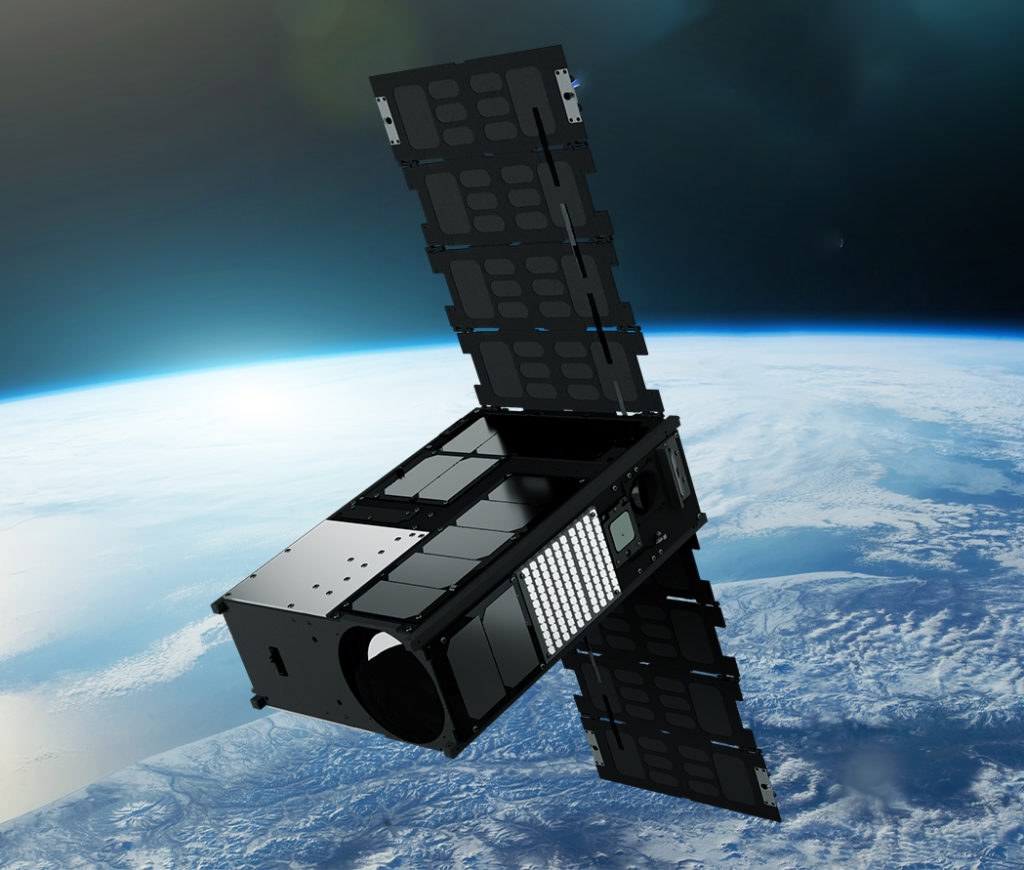
Empower your business with the most insight-rich geospatial imagery data currently available.
![Wyvern](https://cdn.agtech.world/1099/01HWNHXMDD9W2QB1XXQPTQBD2B.jpg)
Dragonette Hyperspectral Imaging
Wyvern
0
![EarthTones](https://cdn.agtech.world/1247/01HXGP5F5AQWRNREXXW65BW7W8.png)
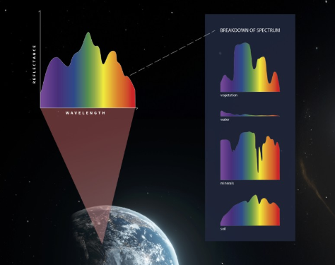
EarthTones is Esper’s flagship product aiming to deliver real time site specific hyperspectral imagery data to support industry leaders.
![Esper Satellite Imagery](https://cdn.agtech.world/1245/01HXF08AFK63QJ8FQQ3YS33HCQ.jpg)
EarthTones
Esper Satellite Imagery
0
![Farm Reports](https://cdn.agtech.world/768/01HSJW2DE8XTH88TM8HMA5ZQJ0.jpg)
Access ~30 years of satellite imagery and generate reports on trends in land condition indicators - monthly rainfall, seasonal ground cover, annual tree cover change and forest carbon.
![Cibolabs Pty Ltd](https://cdn.agtech.world/766/01HSJVD0VJE4A56JP9K3G5CDPK.jpg)
Farm Reports
Cibolabs Pty Ltd
0
![Field Boundary Detection](https://cdn.agtech.world/1003/01HVY8CZ6Q4ZBVQA3ZKTERZPDS.png)
Automatic Field Boundary Detection Using Neural Networks
![EOS Data Analytics Inc](https://cdn.agtech.world/1000/01HVY766QRNBQEGKBPCNBFKJJH.png)
Field Boundary Detection
EOS Data Analytics Inc
0
![Field Intelligence](https://cdn.agtech.world/1088/01HWFC2KRYTY5A5DJ0AA2C7F1R.jpg)
Go beyond NDVI with our calibrated vegetation indices.
![LandScan LLC](https://cdn.agtech.world/1087/01HWFBA3M326EFN4MCQDP0RGRA.jpg)
Field Intelligence
LandScan LLC
0
![Harvest Dynamics Monitoring](https://cdn.agtech.world/1005/01HVY92MYAQM2GXXZ7TC20V4E2.png)
Remote Harvest Dynamics Monitoring
![EOS Data Analytics Inc](https://cdn.agtech.world/1000/01HVY766QRNBQEGKBPCNBFKJJH.png)
Harvest Dynamics Monitoring
EOS Data Analytics Inc
0
![Meteoblue](https://cdn.agtech.world/1018/01HW13CGMXVHKA7ZSW6MPZE8Z1.png)
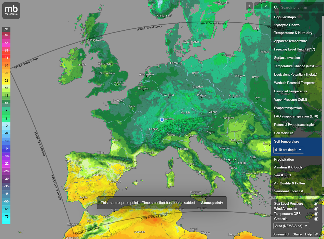
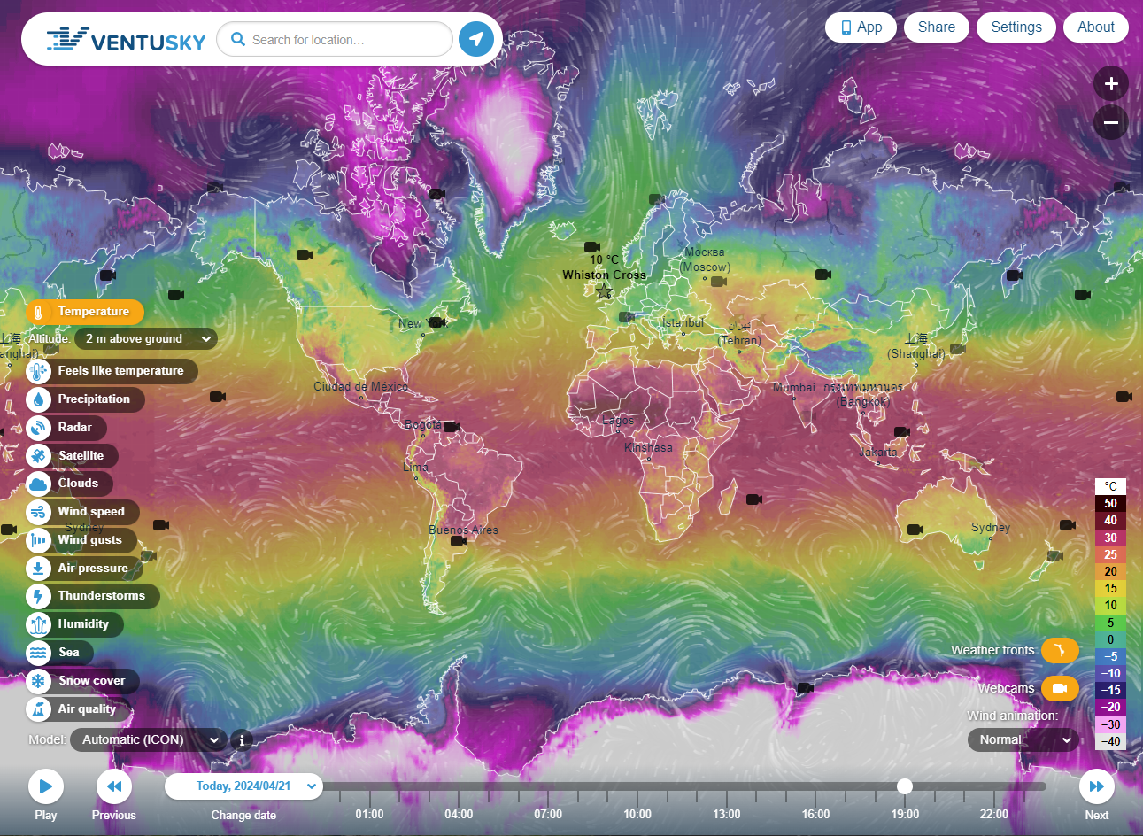
Meteoblue produces top-quality weather data – for any point on land or sea in the world.
![Meteoblue](https://cdn.agtech.world/1016/01HW12GYZN615234FHXG23PPN1.png)
Meteoblue
Meteoblue
0
![OctopusBot](https://cdn.agtech.world/1283/01HY5JDE9NP2G8C9BW0RX9MMT5.png)
AI-Powered Predictive Analytics.
Empowering confident data-driven decisions for commodity market players through AI Forecasts
![Octopusbot](https://cdn.agtech.world/1282/01HY5HWXBACZ6XFDKGERHHSD1Q.jpg)
OctopusBot
Octopusbot
0
![OneSoil Global Analytics](https://agtech.world/storage/266/01HMEP77PMRS4R3BG5XMMZM0F6.jpg)
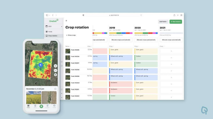
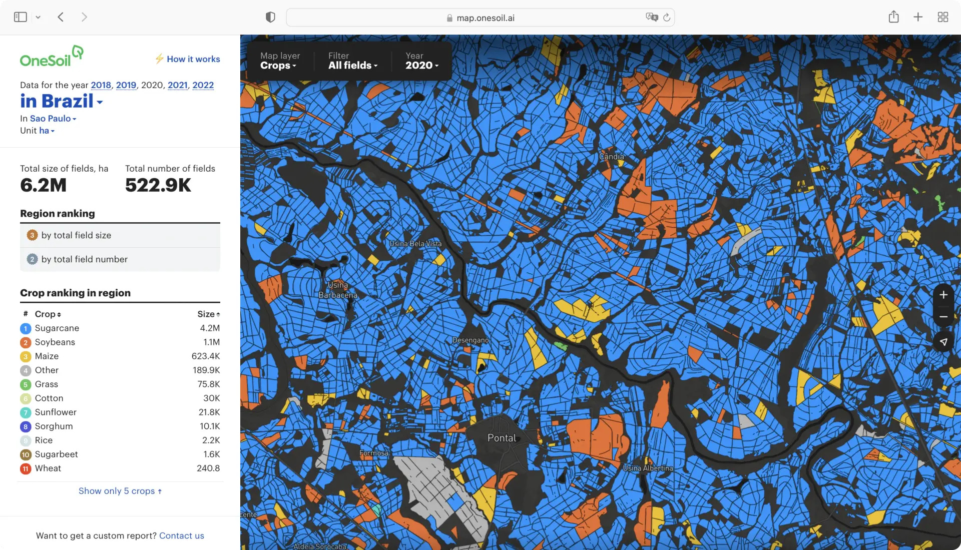
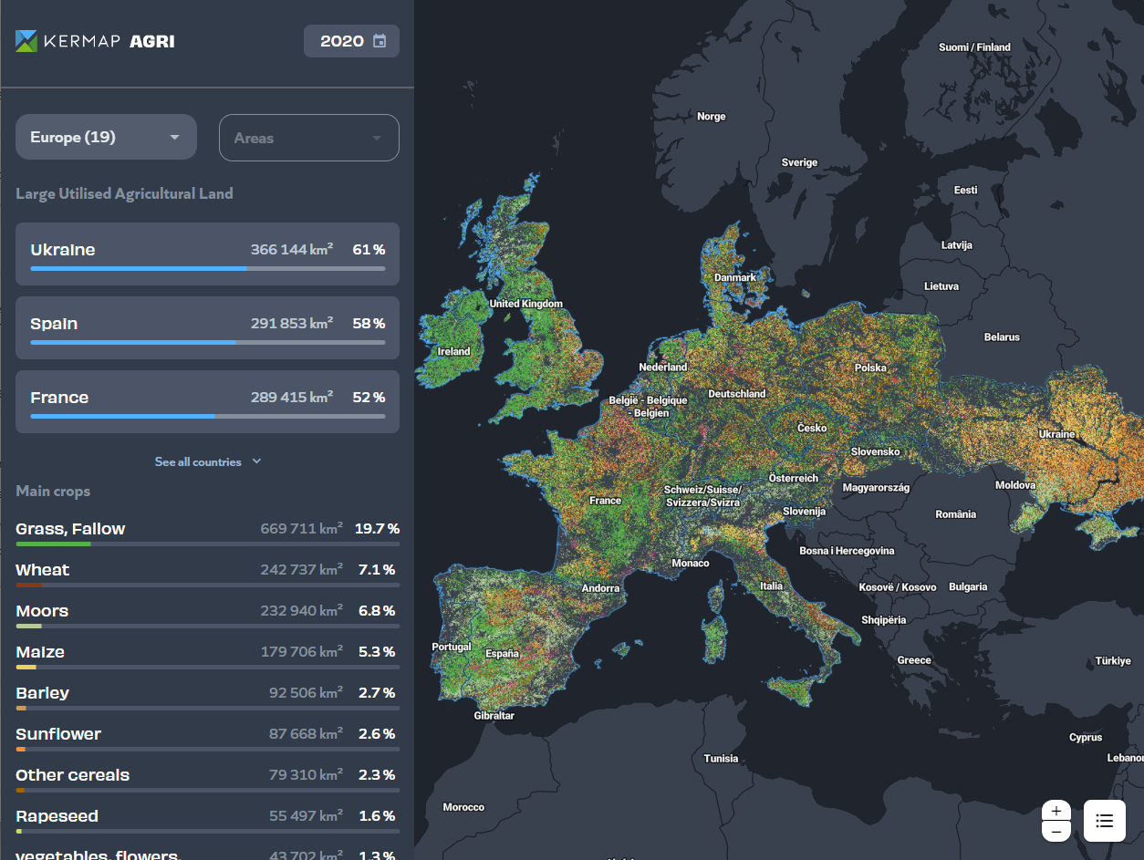
Get Agricultural Data on Any Region
![OneSoil AG](https://agtech.world/storage/256/01HMBC93F1RNM9GYN3EQMHCVZC.jpg)
OneSoil Global Analytics
OneSoil AG
0
![Pairtree PLUS](https://cdn.agtech.world/1293/01HY5KHKKBVH74TKCQ94Q8SGM0.jpg)
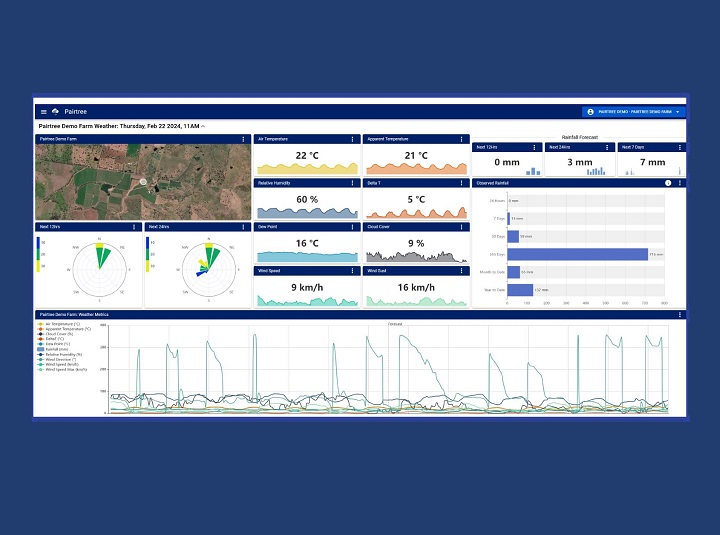
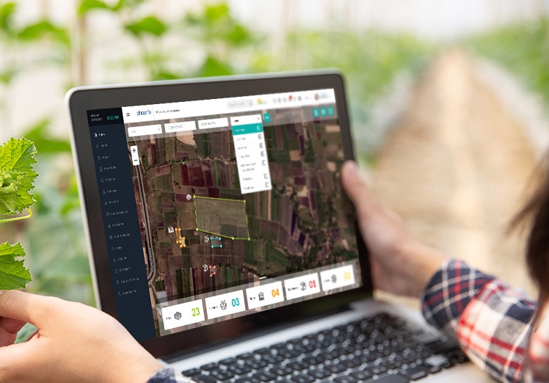
Imagine all the farm data you need connected in one place.
![Pairtree Intelligence Pty Ltd](https://cdn.agtech.world/1284/01HY5JP4RPFN7VESTQXRYEDWRB.jpg)
Pairtree PLUS
Pairtree Intelligence Pty Ltd
0
![Paul-Tech Soil sensor](https://cdn.agtech.world/801/01HSKJXD38Z63PFX61377H5EEV.jpg)
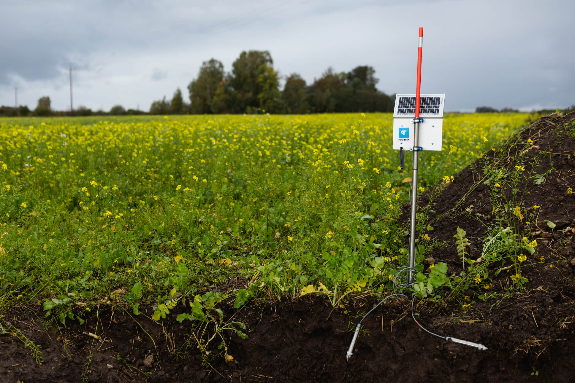
Use your field’s data to save money
![Paul-Tech](https://cdn.agtech.world/800/01HSKJGRW96ET0JCXJ5W06K1KD.png)
Paul-Tech Soil sensor
Paul-Tech
0
![Perennial](https://cdn.agtech.world/869/01HVFAA1GD2A30D07CYH30CE2Q.png)
Perennial uses the world’s most advanced remote measurement technology for soil carbon sequestration and emissions.
![Cloud Agronomics Inc.](https://cdn.agtech.world/867/01HVF9N7W90S0299MZS2VBP8GB.jpg)
Perennial
Cloud Agronomics Inc.
0