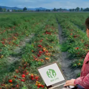
TOBACCODSS is the solution for tobacco farms that want to optimize their fields management for the cultivation of tobacco.
It is a control and forecast tool that helps to apply effective defence and management strategies for the fields in order to increase quality and quantity of the yield.
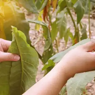
TOBACCODSS supports the decisions of farmers and technicians by integrating data from forecast models, crop scouting, and remote sensing.
Why choose TobaccoDSS:
- Increase the quality and quantity of cultivated tobacco
- Reduce management costs
- Prevent the spread of stress and diseases
- Reduce the use of water
- Monitor the field, also remotely
- Reduce environmental impact
Features
- FIELD MAPPING
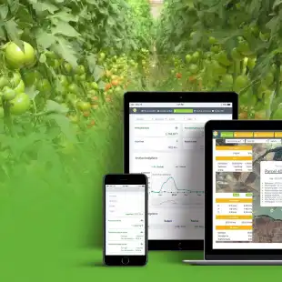
Geolocate the field on the map and draw it. Features will be immediately hooked. You can enable the cadastral map and enter sheet and parcel information. - SATELLITE IMAGERY
Consult Sentinel-2 satellite images with vigor, water stress and chlorophyll indices, to assess crop health and plan monitoring activities. - CROP OPERATIONS
Register where, how and when crop operations (irrigation, transplanting, treatments and harvest) have been carried out. You can also access phytosanitary products database. - PRODUCTION LOTS
Create and assign to each crop its own production lot to improve traceability of operations. A QR code is also generated that allows you to access and share the dedicated web page where you can consult all the information on the product. - SUSTAINABILITY
Monitor the economic (yield, production) and environmental (water consumption, input control and farm biodiversity) sustainability indicators of your farm. You can set the level to be reached for each indicator and monitor how the work is going. - WEATHER FORECASTS
Consult professional weather forecasts up to 7 days updated every hour: temperature, humidity, wind speed, rainfall. - PHENOLOGY FORECAST MODEL
Prediction of the number of leaves, flowering percentage and height development of the crop to assess its needs. - IRRIGATION FORECAST MODEL
Evaluation of water requirements to carry out irrigation when necessary with the right amount of water. - FERTILIZATION FORECAST MODEL
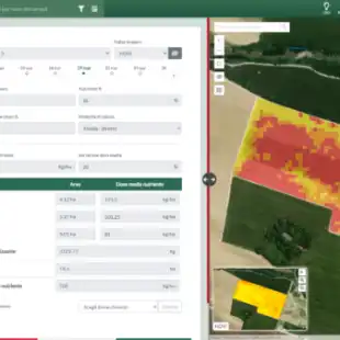
Calculation of the total nitrogen, phosphorus and potassium needs (Kg/ha) required by the crop in order to obtain important suggestions on the doses of fertilizer to be applied. - PEST AND DISEASES FORECAST MODEL
Prediction of infestations and diseases to assess the risk of pest (Helicoverpa armigera) and diseases (Peronospora) and act promptly. - DECISION SUPPORT
Suggest operations to be carried out based on collected data. - CROP SCOUTING
Geolocate and register data from crop scouting by using the App mobile: pest and diseas, crop damages, phenology, traps and catches. - TASK MANAGEMENT
Create and assign tasks to be done in the farms to your collaborator in real time. - WEATHER STATIONS
Virtual weather station included; physical weather stations and sensors can be purchased or integrated, if already present in the company. - PRESCRIPTION MAPS
Choose the most suitable vegetation index to draw up the prescription map and carry out a variable rate fertilization. - MACHINERY
Register your agricultural machinery, any problems and maintenance carried out. You can also connect them to Agricolus by using Agrirouter.
Gallery
Reviews
Sign-in to leave a review for the solution.
0.0/5
0 Reviews
Questions
Sign-in to leave ask a question about the solution.