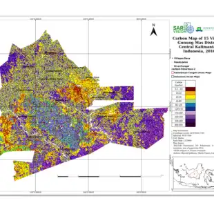
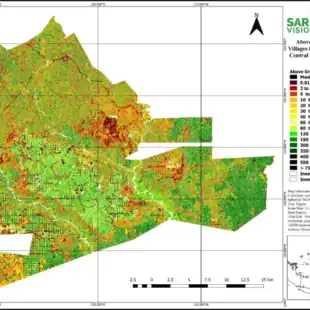
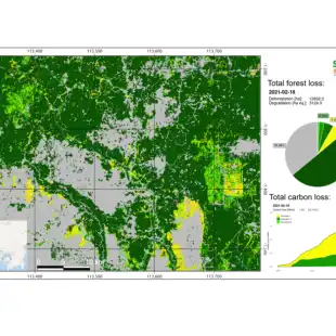
SarVision developed the SarCarbon system for accurate large scale biomass and carbon mapping. Multi sensor baseline maps, including GEDI lidar data are combined with SarSentry’s forest change maps to assess near real time biomass and carbon changes in forest areas. This new approach includes the significant contribution of forest degradation as part of the biomass. The SarCarbon system not only improves the accuracy of existing satellite based methods, it also allows to monitor carbon changes over time
Gallery
Reviews
Sign-in to leave a review for the solution.
0.0/5
0 Reviews
Questions
Sign-in to leave ask a question about the solution.