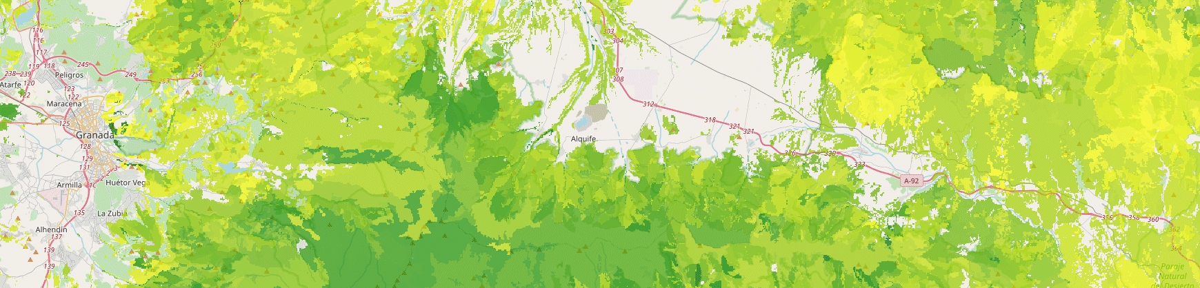
6th Grain’s Runoff & Leaching Tool helps identify and engage with users who have erosion problems. Our Tool displays runoff and leaching hotspots in an easy-to-use interface. These hotspot maps are generated using hydrological models. The Runoff & Leaching Tool provides soil and water quality Best Management Practices in order to fully support the user.
Key Features
- Runoff & Leaching Maps
- Best Management Practices Report
Gallery
Reviews
Sign-in to leave a review for the solution.
0.0/5
0 Reviews
Questions
Sign-in to leave ask a question about the solution.