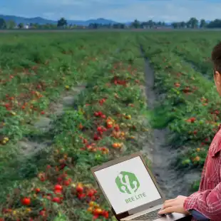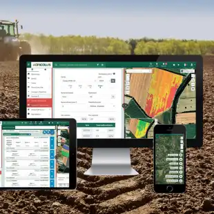
Agricolus Plus is the solution for farms that want advanced technological support for a 360-degree agronomic management.
The platform can be customized according to the specific needs of each farm, in particular those with several crops which want to use forecast models and connect weather stations.
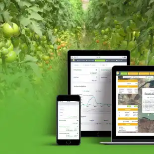
Features
- FIELD MAPPING
Geolocate the field on the map and draw it: features will be immediately hooked. You can enable the cadastral map and enter sheet and parcel information. - SATELLITE IMAGERY
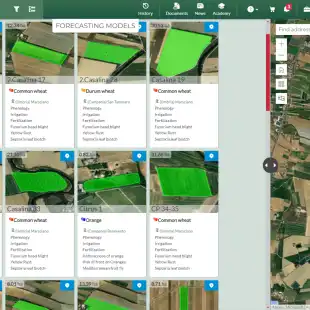
Consult Sentinel-2 satellite images of the field with vigor, water stress and chlorophyll indices, provided every 5 days (in the absence of cloud cover) at a spatial resolution of 10 meters. - FORECAST MODELS
for phenology, irrigation and fertilization available for all crops. - SUSTAINABILITY
Monitor the economic (yield, production) and environmental (water consumption, input control and farm biodiversity) sustainability indicators of your farm. You can set the level to be reached for each indicator and monitor how the work is going. - CROP OPERATIONS
Register where, how and when crop operations such as irrigation, treatments and fertilization have been carried out. You can also access phytosanitary products database. - PRODUCTION LOTS
Create and assign to each crop its own production lot to improve traceability of operations. A QR code is also generated that allows you to access and share the dedicated web page where you can consult all the information on the product. - CROP SCOUTING
Geolocate and register into the platform the field activities with Agricolus Farmer app: crop operations, soil analysis, crop damages, phenology, pests and diseases, traps and catches. - WEATHER FORECASTS
Consult professional weather forecasts up to 7 days updated every hour: temperature, humidity, wind speed, rainfall. - WEATHER STATIONS
Virtual weather station included to use forecast models; physical weather stations and sensors can be purchased or integrated, if already present in the company. - DECISION SUPPORT
Decision support with historical data and forecast information of interest and suggestions on actions to be taken. - CROP PLANNING
Register and quickly visualize your crop planning to better plan the following season. - PRESCRIPTION MAPS
Choose the most suitable vegetation index to draw up the prescription map and carry out a variable rate fertilization. - ISSUES
Register all problems found in the field that must be communicated or solved. - TASK MANAGEMENT
Create and assign to your collaborators the activities to be carried out in the farm in real time. - DATA HISTORY
Consult your farm’s historical data and select a date from the past to analyze and compare accurate information on previous seasons. - USER MANAGEMENT
Invite your collaborators into Agricolus to allow them to share and record data on your farm’s account. - MACHINERY
Register your agricultural machinery, any problems and maintenance carried out. You can also connect them to Agricolus by using Agrirouter.
Additional modules and services
- HISTORICAL SATELLITE IMAGES
processing of satellite images dating back to past years. - AGROWEATHER STATIONS AND TRAPS
purchase or rental of agrometeo stations and automatic traps within the platform. - SPECIFIC FEATURES
for OLIVE, GRAPE, TOBACCO, CORN, WINTER CEREALS, TOMATO.
Gallery
Reviews
Sign-in to leave a review for the solution.
0.0/5
0 Reviews
Questions
Sign-in to leave ask a question about the solution.