Your farming work will rapidly evolve with the AgriBus series. A low cost GPS navigation system. We’ve made a simple and inexpensive GPS navigation system giving you accurate and stress-free farming. Highly functional AgriBus Series helps you improve your earnings.
- Reduces costs with inexpensive systems
The cost of the GPS navigation system is significantly lower than that of conventional GPS navigation systems. You can easily download an application to your smartphone or tablet. This straight-ahead operation makes it possible to reduce labor and material costs. - Handles diverse tasks with high scalability
It can be installed on a variety of agricultural machinery and vehicles, including tractors, combines, and self-propelled sprayers and supports straight-ahead operations in a wide field. The collaboration with the AgriBus series enables the recording and use of agricultural work information, communication with agricultural machinery, and the use of IoTs and robotics. - Already used by farmers worldwide
The world’s top market share for GPS navigation apps. With more than 1.7 million total installed users in which, more than 90% of the downloads are from overseas and it is used in more than 140 countries (as of Feb. 2022). Users have been growing steadily since its launch in 2015 and it has gained the trust of farmers around the world.
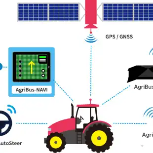
AgriBus-NAVI
Simple and low-cost tractor driving support app
- Straight and evenly spaced is directly related to profitability
AgriBus-NAVI is a GNSS/GPS guidance application for Android that can be mounted on agricultural vehicles such as tractors and combine harvesters to assist in “driving straight and evenly spaced” in the Cultivated land.
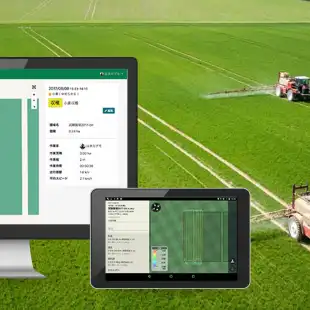
Compatible with smartphones and tablets running Android 6.0 and above - Cloud management of Work history and Cultivated land
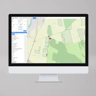
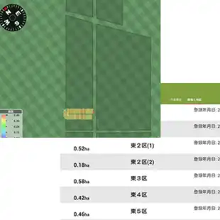
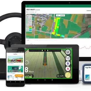
With AgriBus-Web, you can view your work Work history and create Cultivated land areas using a web browser. The Work history allows you to check later “when, where and how you ran”, so you can use it to look back on your work. The height information is also recorded, so you can see the height difference of the Cultivated land. - Just download the app
Supported smartphones and tablets. Compatible with Android 5.0 and above smartphones and tablets with GPS.
AgriBus-Web
- Manage fields and operations with a web browser
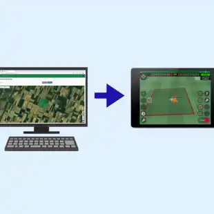
When you create Cultivated land data from satellite maps, the created Cultivated land will be depicted on the guidance map in the AgriBus-NAVI application.
By logging in with a web browser on your computer, you can import map data in KML format created by GoogleEarth or other means, and export your work data in TSV format.
*A subscription to the paid plan [Plus]is required to use this service. - Backup data
By storing data in the cloud, the same data can be used in situations such as restoring data from a backup when reinstalling an application, changing Android devices, or using a second or third device.
*Backup of Cultivated land does not require a subscription to a paid plan, but the retention period for Work history is indefinite with the purchase of a subscription to [Plus]. - Establishment of My Standards Bureau
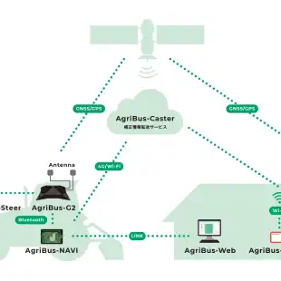
If you have the AgriBus-GMiniR, you can set up an RTK-GNSS reference station (My Reference Station) at your home.
After installation, simply log in on the AgriBus-NAVI side to receive correction information from My Reference Station.
*A subscription to the paid plan [Plus]is required to use this service.
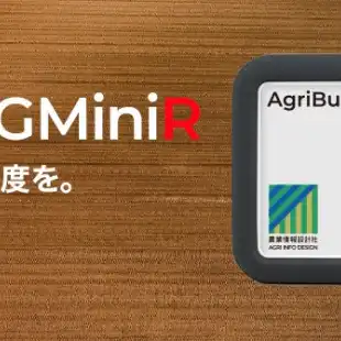
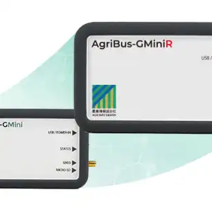
AgriBus-GMiniR
- Dual-frequency RTK-GNSS receiver
The AgriBus-GMiniR, designed for ultra-high precision guidance with AgriBus-NAVI, is equipped with a dual-frequency RTK-GNSS/GPS module from u-blox and is capable of centimeter-level ultra-high precision positioning. The u-blox RTK-GNSS/GPS module can be used as a reference station, and can also be easily switched to a reference station via a dedicated application. The sensor-based path prediction and correction minimize positioning errors. - Dual-frequency RTK-GNSS module for high-precision positioning
The ZED-F9P is equipped with u-blox’ dual-frequency RTK-GNSS module ZED-F9P, while maintaining the palm-sized design. It can be used as either a reference or mobile station with RTK positioning. - Easier reference station operation
Ease of use as a reference station has been refined. The AgriBus-GMiniR can be operated as a stand-alone reference station by automatically connecting to the AgriBus-Caster. There is no need to prepare a separate PC or smartphone for reference station use. The ” AgriBus-GTools” application can easily switch between the mobile station and the reference station. - Equipped with gyro sensor and attitude sensor
The gyro sensor provides highly accurate path prediction, and the attitude sensor intelligently compensates for misalignments between the antenna position and the ground surface position caused by inclination. This minimizes positioning errors and improves the efficiency of agricultural work.
AgriBus-G2
- Ultra-high-precision smart GNSS/GPS device compatible with automatic steering
By mounting it on a tractor and connecting it to a smartphone or tablet with AgriBus-NAVI installed via Bluetooth, it provides ultra-high-precision GPS guidance. By combining it with AgriBus-AutoSteer, it also supports automatic steering. There are plans to expand the functionality to support vehicle speed pulse output and ISOBUS/AG-PORT, allowing for versatile use. - Ultra-precise location information
Equipped with u-blox dual-frequency module ZED-F9P. Dual-frequency RTK enables centimeter-level ultra-high-precision positioning.
In addition, it has an Internet connection function and can connect to a GNSS correction information service by itself to use centimeter-level location information.
*You can use centimeter-level location information by using "AgriBus-GMiniR" etc. as a reference station for RTK-GNSS and transferring correction information to AgriBus-G2 using the RTK-GNSS correction information transfer service "AgriBus-Caster".
*To use AgriBus-Caster, you need to register with "AgriBus-Web" and subscribe to the standard plan for the "AgriBus-NAVI" app.
*A standard plan subscription is required for 3G communication with AgriBus-G2 - Accurate heading output
Equipped with two GNSS modules, it detects the correct direction and displays no distortion even when moving forward or backward or at low speeds. - Vehicle speed-linked pulse output
Vehicle speed pulse output compatible with both domestic and imported tractors.
Connect to implements with a vehicle speed interlocking function for precise work.
No need to install sensors on wheels or make adjustments after installation. - Optimal Bluetooth connection for tablets and smartphones
Supports wireless connection via Bluetooth. You can use your tablet or smartphone while charging it. - ISOBUS/AG-PORT compatible (planned)
It is possible to connect work machines that comply with domestic and international standards (Note: Currently under development. Certification is planned).
ISOBUS: A communications standard established by the International Agricultural Electronics Foundation (AEF).
AG-PORT: A communications standard established by the Japan Agricultural Machinery Manufacturers' Association. - Scalability
By rewriting the built-in software, you can upgrade and expand the functions, allowing you to use it for a long time.
Gallery


Reviews
Sign-in to leave a review for the solution.
0.0/5
0 Reviews
Questions
Sign-in to leave ask a question about the solution.