aerialPLOT provides accurate imagery, rich data, and powerful analytics for better agribusiness decisions.
- Real Time Imagery Insights
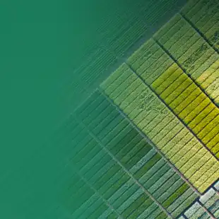
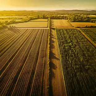
Remotely manage field operations with high-resolution images and extracted digital phenotypes. Our fleet of UAV pilots deliver consistent and calibrated data across the USA to your team. - Total Crop Dynamics
We measure plant phenotypes the entire crop production cycle to truly understand variables that contribute to yield. Integrated aerial time series coupled with additional data layers build a complete picture of crop dynamics for better R&D, marketing, and management. - Modern Web-Based Data Management
Your data is available when you need it, with automated dashboards to quickly see performance trends. Communicate with other researchers, growers, and clients by securely sharing the data in an intuitive cloud platform.
Cultivate Success with Advanced Data Solutions for Agricultural Research.
- Cost Efficiency & Optimization
Our platform is designed to optimize data utility, add confidence and accuracy, provide complete transparency, and reduce the overall timeframes for ag product development and commercialization. - Real-time Data Access
Our web-based platform provides real-time access to a vast array of agricultural data. Researchers and business stakeholders can easily collaborate, share insights, and access the latest information from anywhere in the world. - Advanced Analytics & Reporting
Leverage the power of advanced analytics to make informed decisions in crop development. Our platform compiles your data in live dashboards, with intuitive visualizations and scenario-driven statistics. - Predictive Modeling
Build a better data lake with objective, annotated, multi-layered data sets that quantify relevant crop metrics from high-resolution inputs. aerialPLOT enables model development to predict product performance from R&D data.
Designed in the Field. Built on the Cloud.
Agricultural field research is resource-intensive, with multiple site years and numerous geographical replicates required for holistic datasets.
aerial PLOT has developed a standardized data pipeline that is purpose-built for ag data science. We streamline data capture and cloud transfer for on-demand viewing, sharing, analytics, and reporting.
Our digital toolbox drives more accurate and timely business decisions by integrating geospatial data layers in a modernized digital platform.
- aerial FARMS
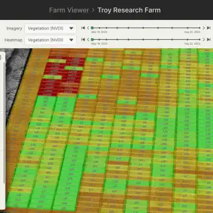
aerial FARMS is the cloud data management platform from aerialPLOT, designed to modernize agricultural research. It provides a data science toolbox to help companies drive business decisions, and find the truth in the field- Secure access & sharing
- Geospatial data visualization
- APIs for multi-format data inputs and outputs
- Executive dashboards & reports
- Automated statistics & data science tools
- aerial LYTX
aerial LYTX is the advanced analytics engine that powers the aerial FARMS platform, transforming raw data into meaningful analytics. Integrating aerial metrics coupled to other data layers enables crop modelling and rigours, ground-truthed data science- Multi-modal data extraction
- Data-driven digital phenotyping
- Spatio-temporal growth curve dynamic data analytics
- Predictive modelling engine
- Customizable data annotations and data curation
- aerial FLIGHT
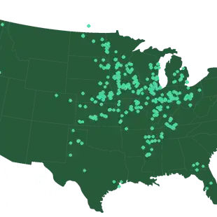
We provide state-of-the-art aerial data collection through a full-service offering across broad geographies- Internal and Full time UAV pilot network deployed across the U.S.
- Calibrated high-res Multispectral & RGB data capture
- Satellite imagery integration
- Extendable ingestion of 3rd party UAV data
Gallery
Reviews
Sign-in to leave a review for the solution.
0.0/5
0 Reviews
Questions
Sign-in to leave ask a question about the solution.